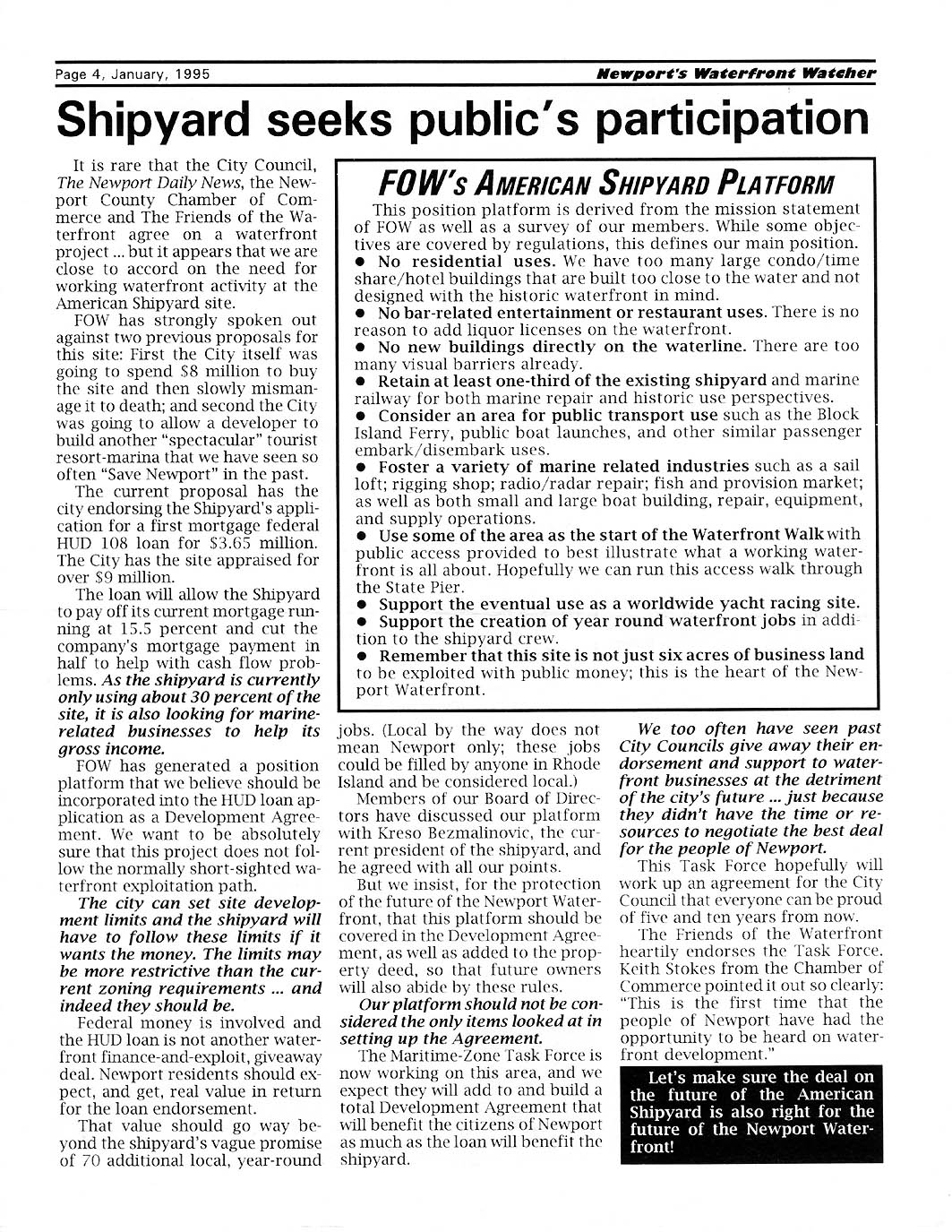
 An opportunity to share thoughts, images, news and feelings
on the Waterfront. An opportunity to share thoughts, images, news and feelings
on the Waterfront. |
|
Newport Waterfront
ON-LINE
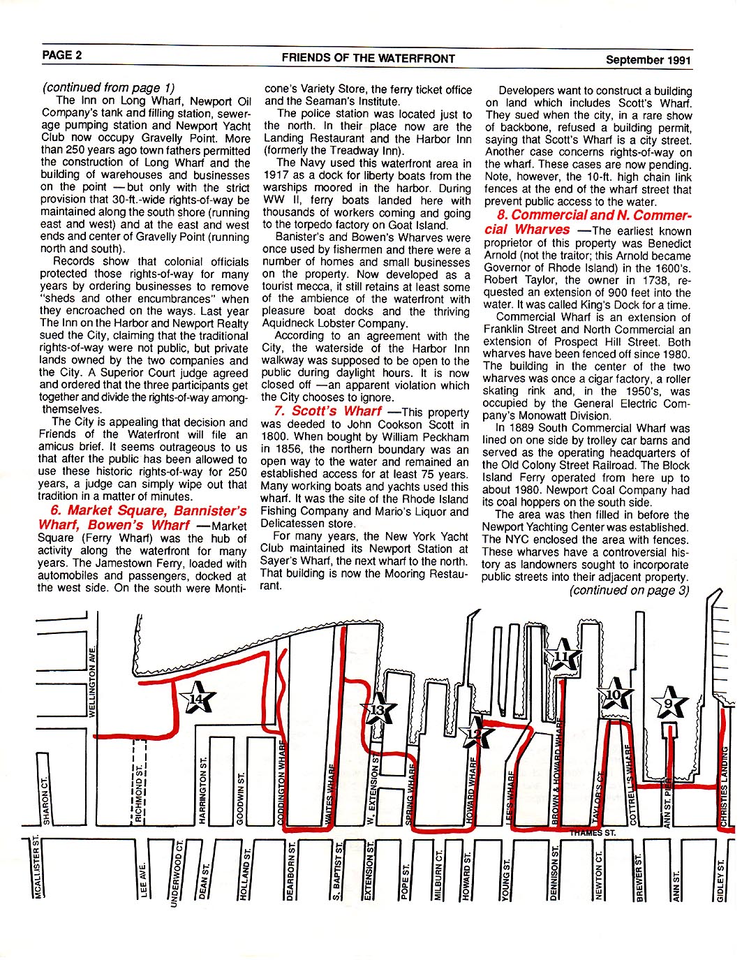
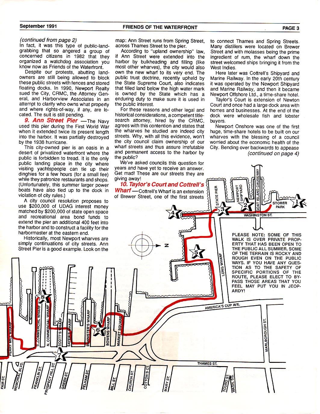
MAP AVAILABLE!
You can print this
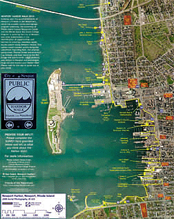
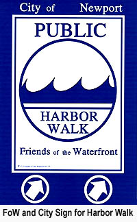
Newport Harbor Walk
Poster
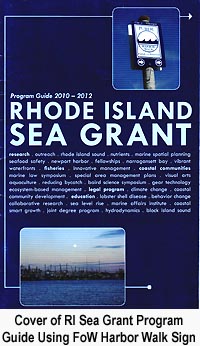
nearly any size. Prepared by Teresa Crean, URI Coastal Resource
Council/RI Sea Grant in collaboration with FoW {Note the PDF file is 3MB large
-- click on image to download file.}
Newport Shoreline Archive
Newport City Manager Memo re Status
of Navy Hospital Land, June, 2014
l
Newport Navy Property
Memo 2014
"Abandonment Statute Is
the Only Method by Which a Municipality May Abandon a Public Highway." April,
2012
l
RI Supreme Court Ruling on Newport's Washington St. Extension
Newport City Council Workshop Slideshow
Presentation from Sea Grant and FXM Associates -- Nov. 9, 2010
l Newport RI
Waterfront Economic Study by Sea Grant and FXM Associates.
FXM Associates Summary Report "The
Contribution of Waterfront Land Uses to Municipal Revenues in Newport"
l
FXM Study 2010
What Will Newport's Waterfront Look
Like in 2030. A Summary Report June 11, 2008.
l Newport 2030
At a Harbor Walk backgound meeting
several years ago three slide shows were presented and each summarized in a PDF
file.
[These are LARGE pdf files and may take a while to download.] While
audio is not available the photos and illustrations are informative:
l Garman History of
Newport RI Waterfront
l
Taylor & Partners 2004 Urban Design for
Central Newport, RI
l
Warner
Presentation
Sea Grant Guide to
Public Access in RI including coverage of Newport starting on pdf page 84.
l Access to the Rhode Island Coast
Detailed history of the legal
development of one section of Newport's Waterfront Walk at Wellington Resort
with FoW input:
l
Wellington's Victory by Blair Gollihur
1999
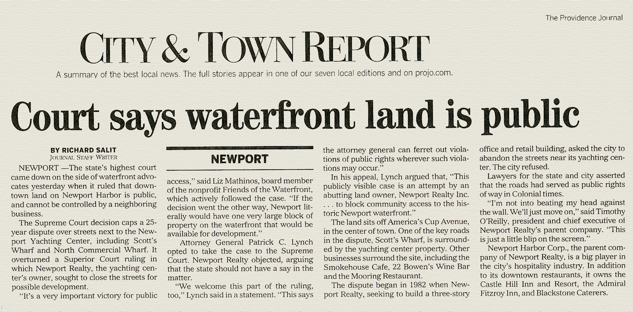
Detailed RI Supreme Court Ruling
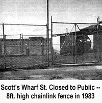
on Streets and Rights of Way in Regard to Newport's Scott's Wharf, North
Commercial and South Commerical Wharfs
l
RI Supreme Court Ruling on
Newport's Scott's Wharf, July, 2005
l
Providence Journal's Summary of the Scott's
Wharf Ruling
Salve Regina U. Study Report
on the
Southern Thames St. Neighborhood History
2004.
Proposal for a
Comprehensive Management Plan for Newport's Cliff Walk -- 1987
l Newport, RI Cliff Walk: a
User Profile
One of the
Original RI Historical Preservation Reports on Newport, RI Waterfront Used by
FoW in the 1980s. [this is a 70MB pdf]
l
Newport,
RI Southern Thames St. Neighborhood Early History
Miscellaneous Documents
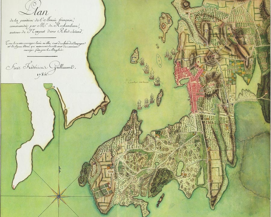
l 1784 Map of
Newport
l
History of Goat
Island
Links of
Interest
l
What is
CRMC
l
CRMC
GIS Mapping of Public RoWs in RI +in to see Newport's
23
|
 |
The Wilfred C. Warren Photo Collection dating from
1900 to 1966
Captain Warren, in addition to being a noted marine photographer and
historian, was also an author of maritime books and publications. He lived on
Newport's Washington St. and photographed his favorite places on the Newport
shoreline. This group is a small selection from his collection now at the
Seamen's Church Institute. |
|
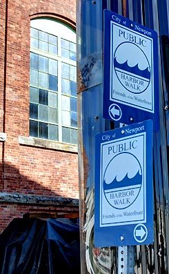
Newport's Harbor Walk all started in 1982. A small band of
concerned citizens {Friends of the Waterfront] realized that in a poor local
economy with U.S. Navy moving its fleet to other states, Newport harbor would
be walled off by developers concentrating on gated high rise condo and
time-share projects.
In the developers' efforts to achieve highest
possible profit, public rights of way and historic uses were fair game for
corporations willing to build fences across roadways to the shore and taking
possession by the lack of public opposition. Yes,no opposition simply because
no one was aware that there were legal public streets about to be pirated away.
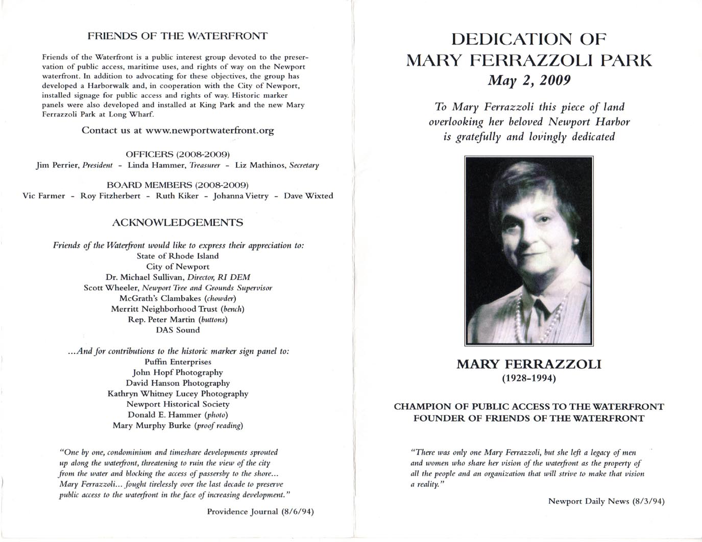
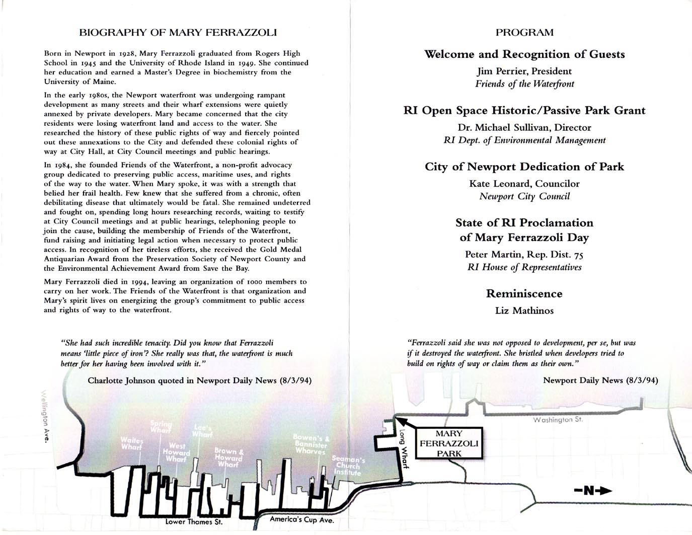
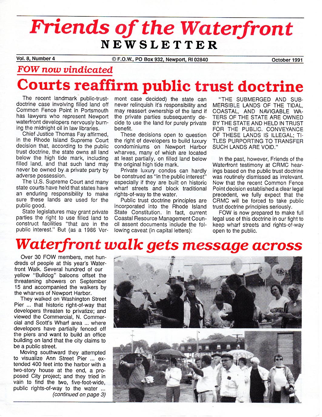
FoW founder Mary Ferrazolli receiving the Award
for Distinguished Service in the field of Historic Preservation from The
Preservation Society of Newport County, 1988. In the first 6 months of 1988,
Mary participated in over 100 public hearings on protecting public access to
the Newport Shoreline and Harborfront.
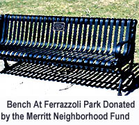
Mary's Park
Dedication Program with Biography:
P 1 |
P 2 |


|
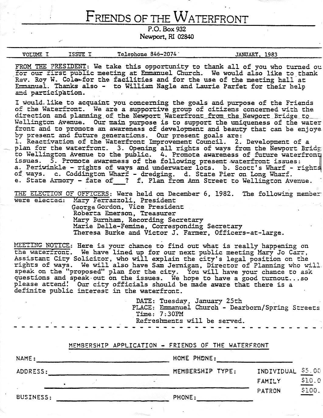
1983 NEWSLETTER - - The Very First FoW
Newsletter
P
1
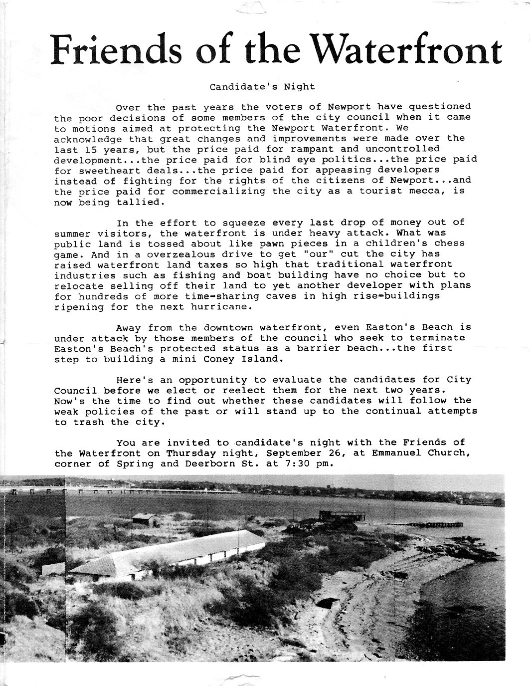
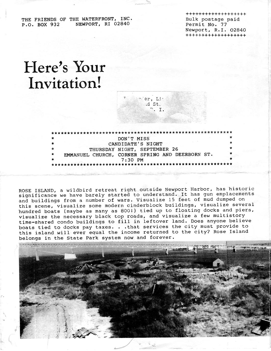
1984 NEWSLETTER - - FoW Does a
Backgrounder for Newport City Council Candidates with Photos of
Problems.
P 1 |
P 2 |
P 3 |
P 4 |
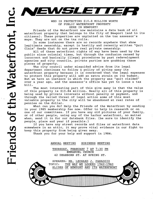
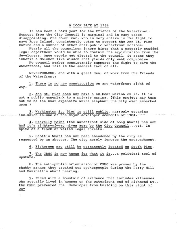
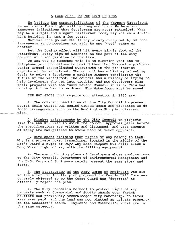
1985
NEWSLETTER - - A Hard Look at the Conditions that Prevailed in
the Early 80s.
P 1 |
P 2 |
P 3 |
P 4 | Why FoW was Launched!
1986
NEWSLETTER - - FoW Gets First 10 Streets Designated CRMC
Rights of Way.
P 1 |
P 2 |
P 3 |
P 4 |
P 5 |
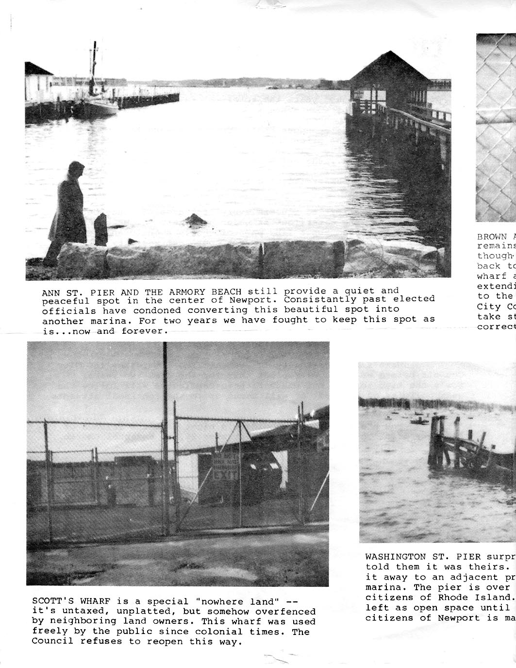
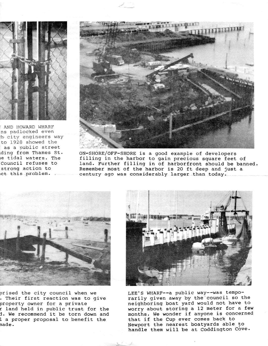
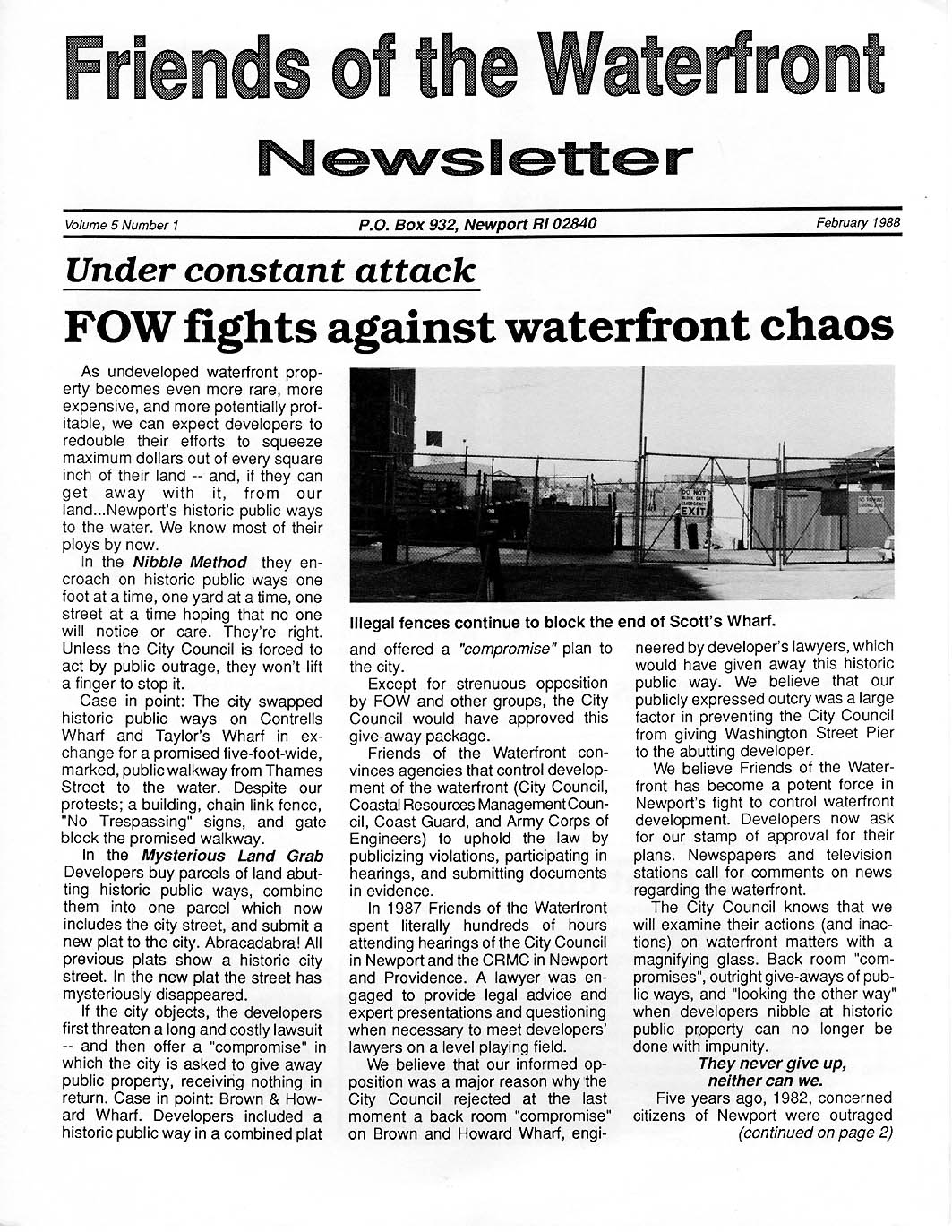
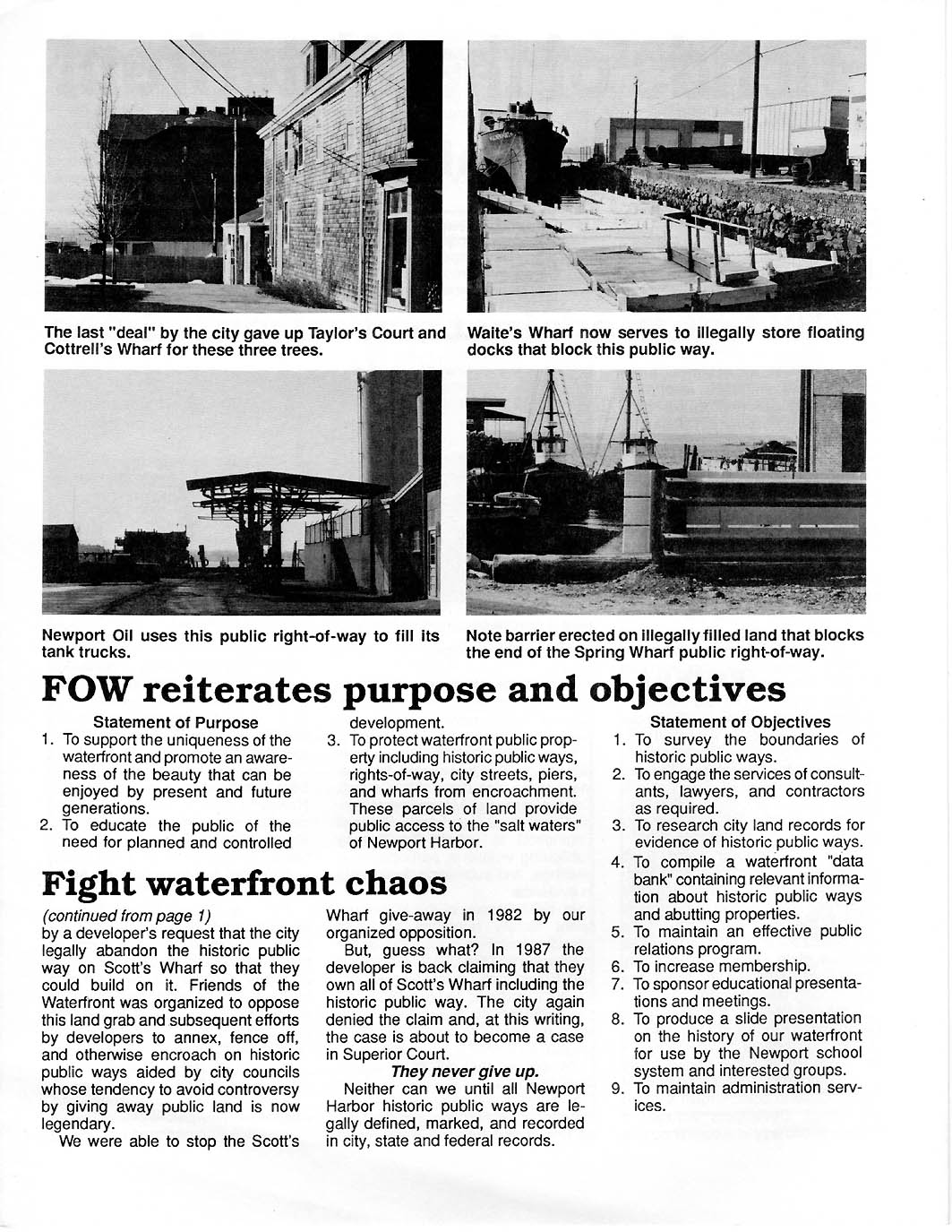
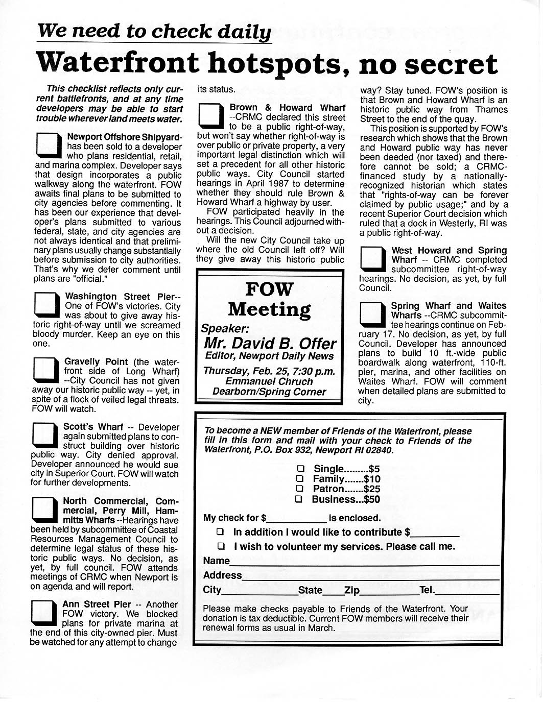
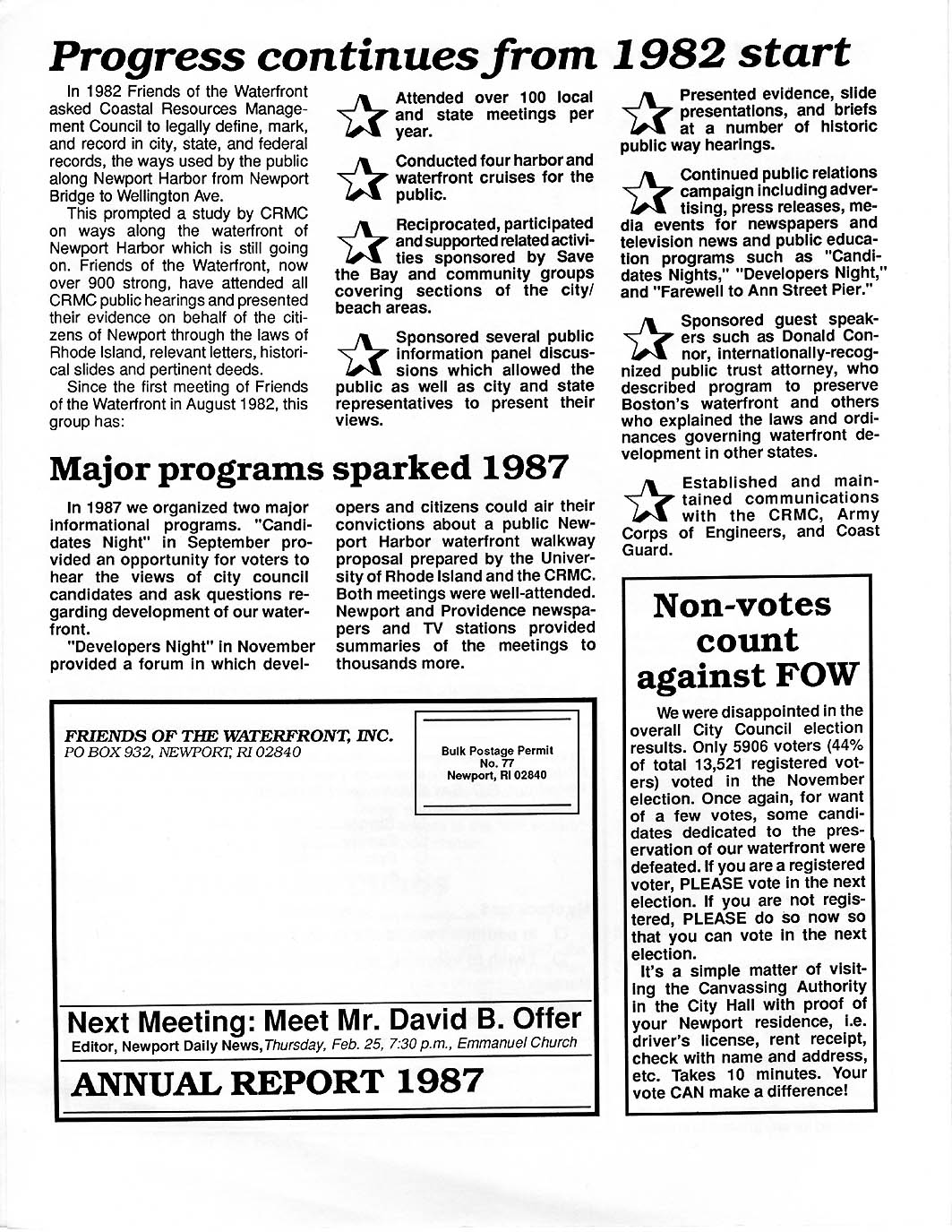
Feb. 1988
NEWSLETTER [1987 recap] - - Five Photos of How Public
Rights of Way Were Misused; FoW Fights Against Waterfront Chaos.
P 1 |
P 2 |
P 3 |
P 4 |
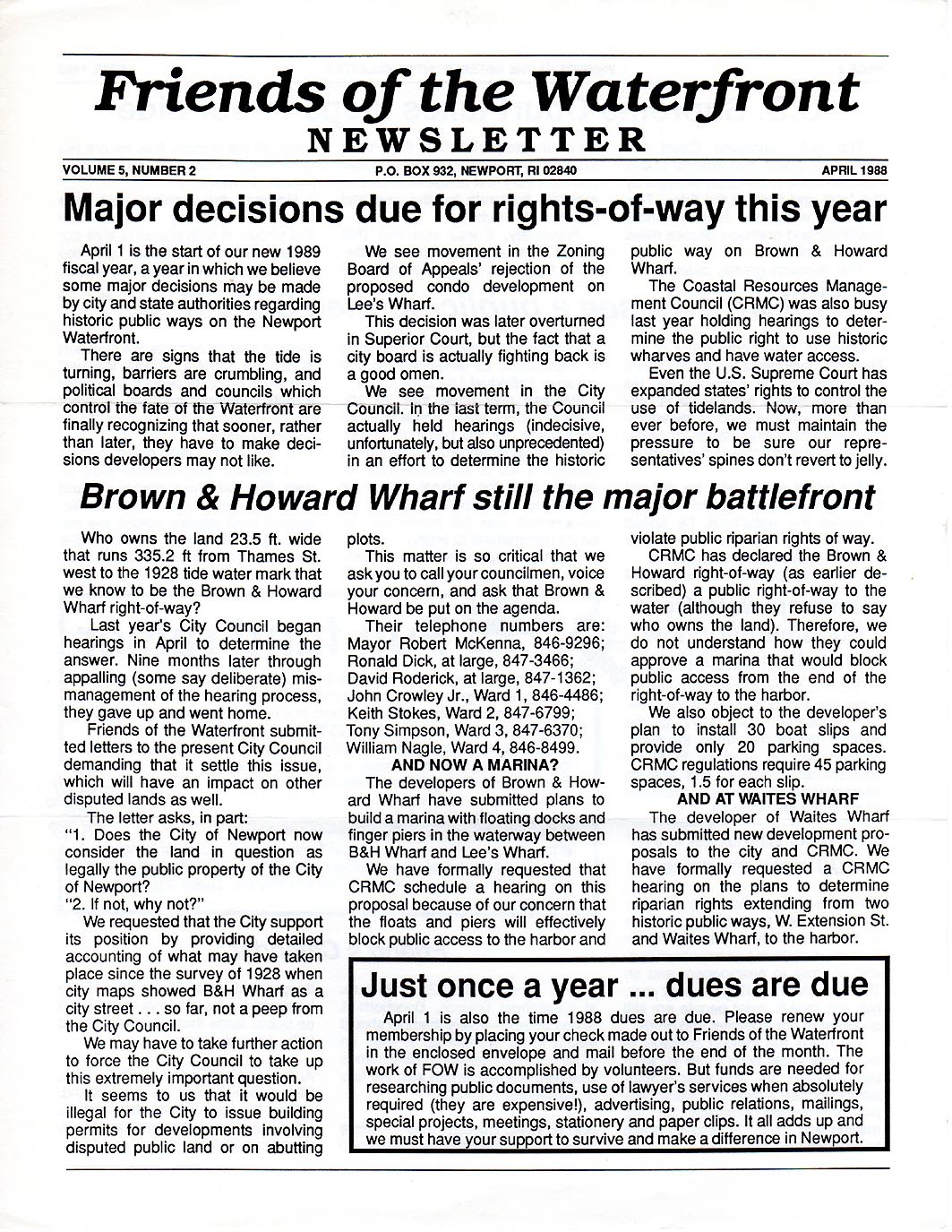
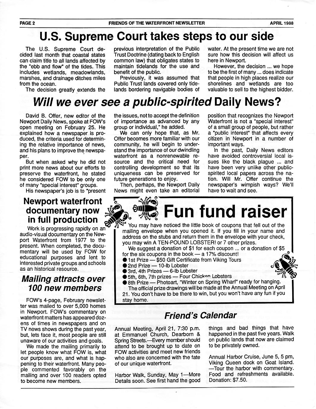
April 1988 NEWSLETTER - - US Supreme
Court Decides Coastal States Can Claim Title to All Lands Affected by Tides.
Some Other Signs that Some Government Groups are Starting to
Understand.
P 1 |
P 2 |
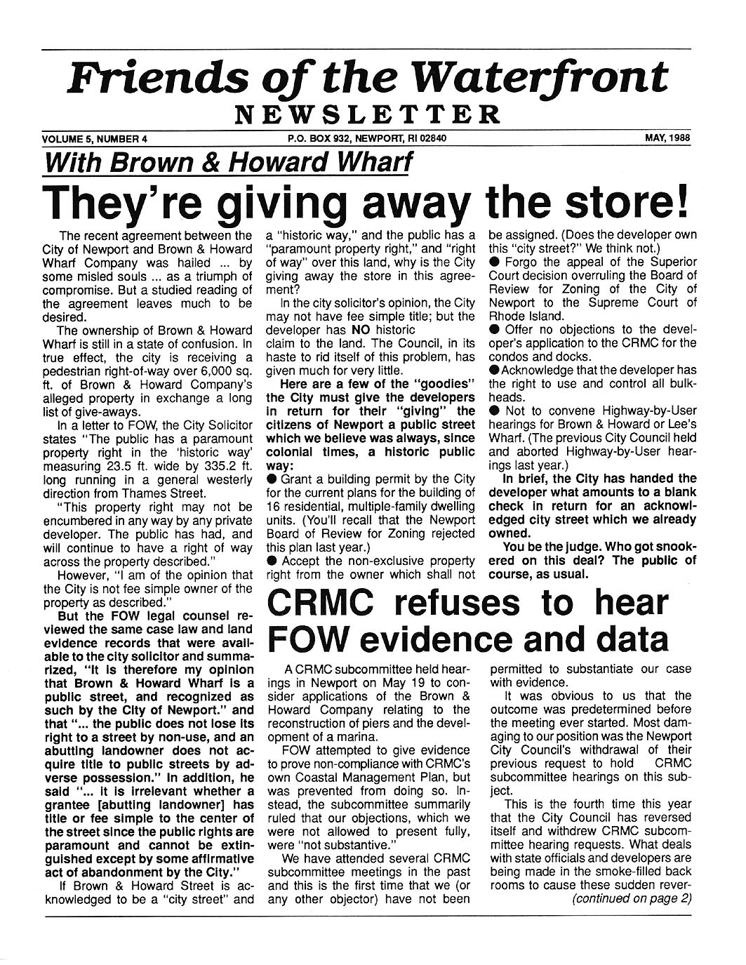
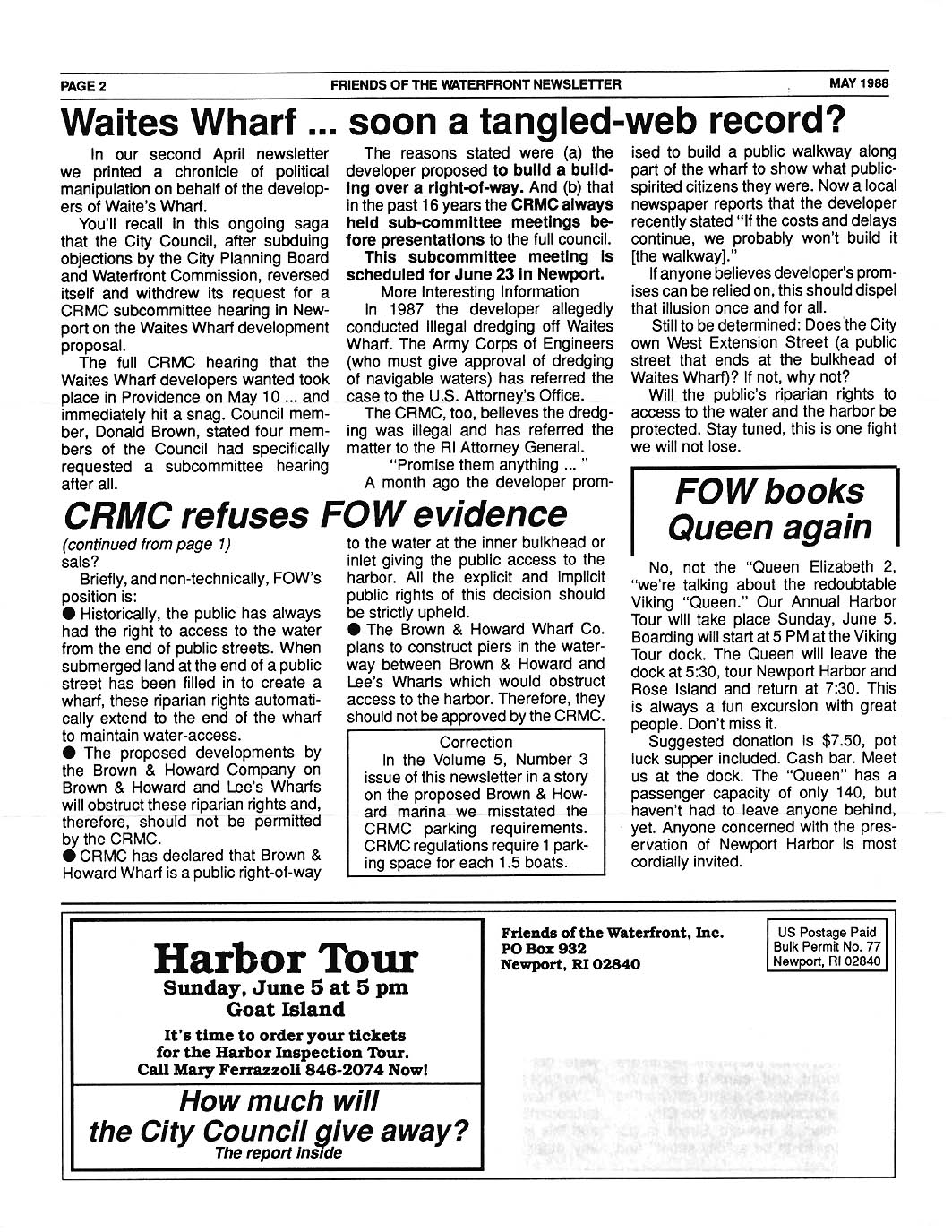
May
1988 NEWSLETTER - - FoW Targets City Council's
Mismanagement in Negotiations on Brown and Howard Wharf St. City Council
Waffles with CRMC Hearings.
P 1 |
P 2 |
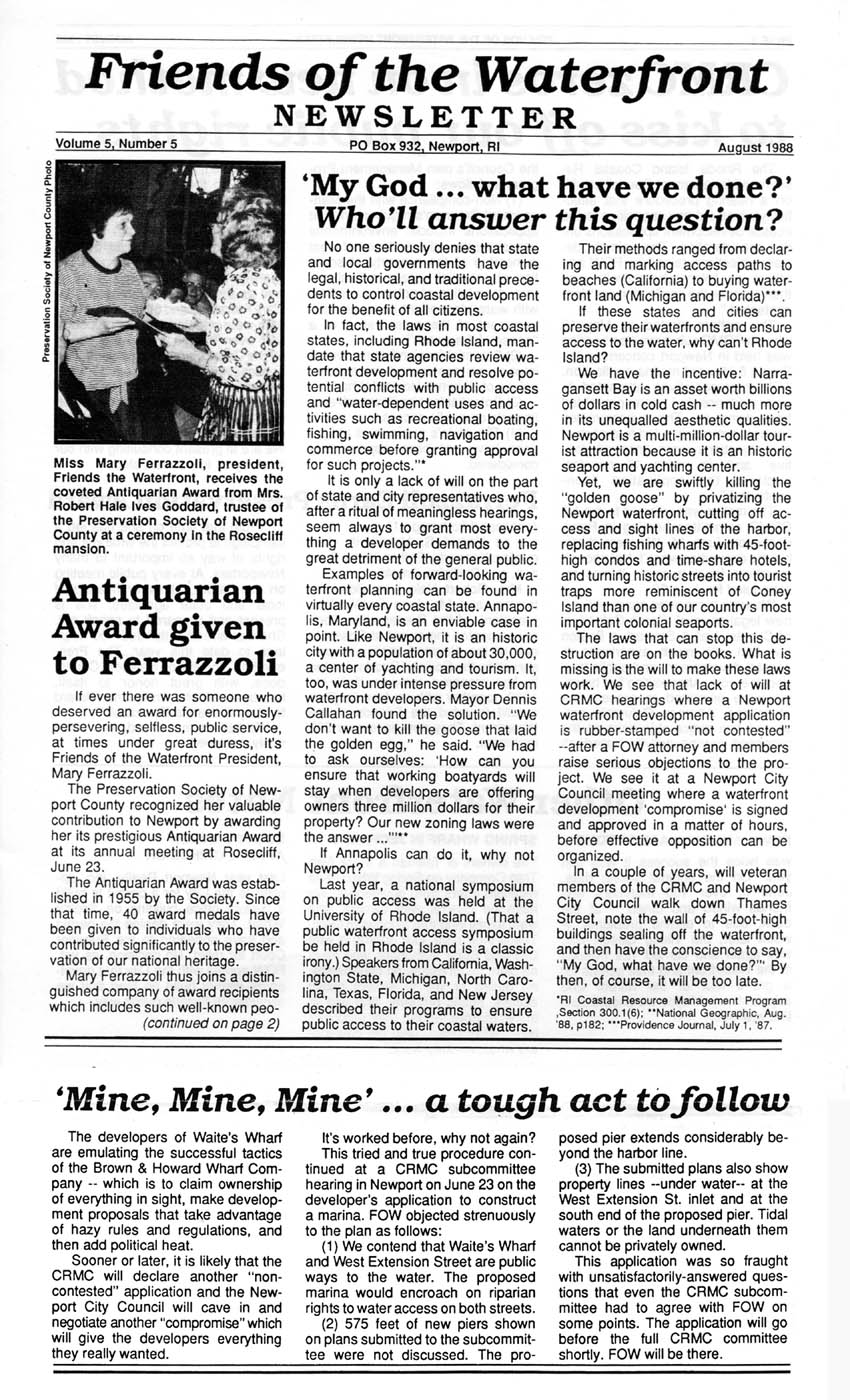
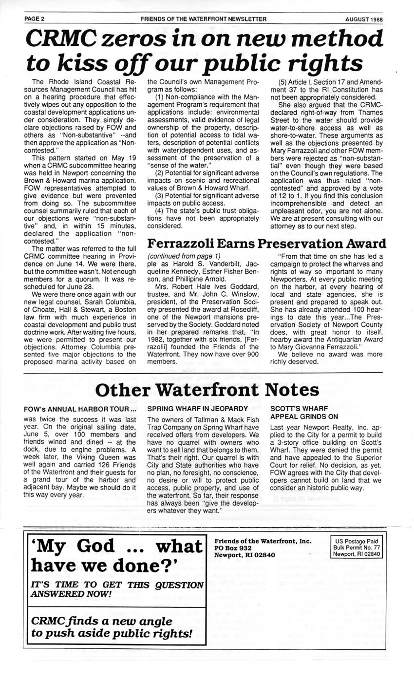
Aug. 1988 NEWSLETTER - - Pres.
Ferrazolli Earns Perservation Society Award; CRMC Subcommittee Rules to Ignore
FoW Testimony
P 1 |
P 2 |
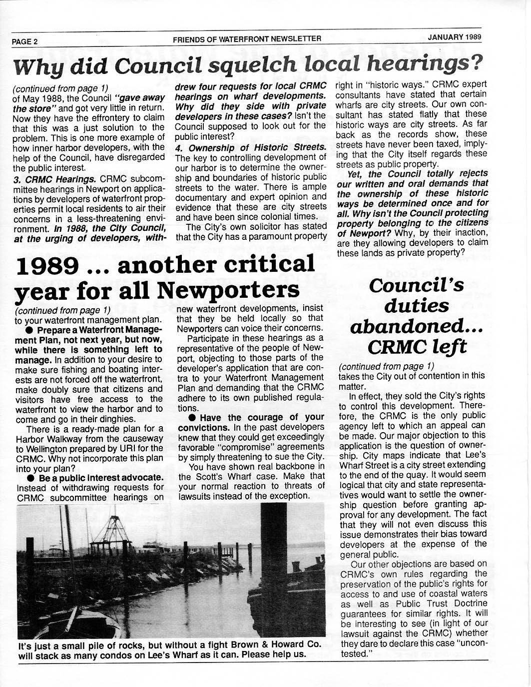
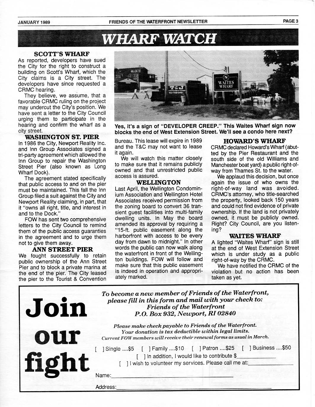
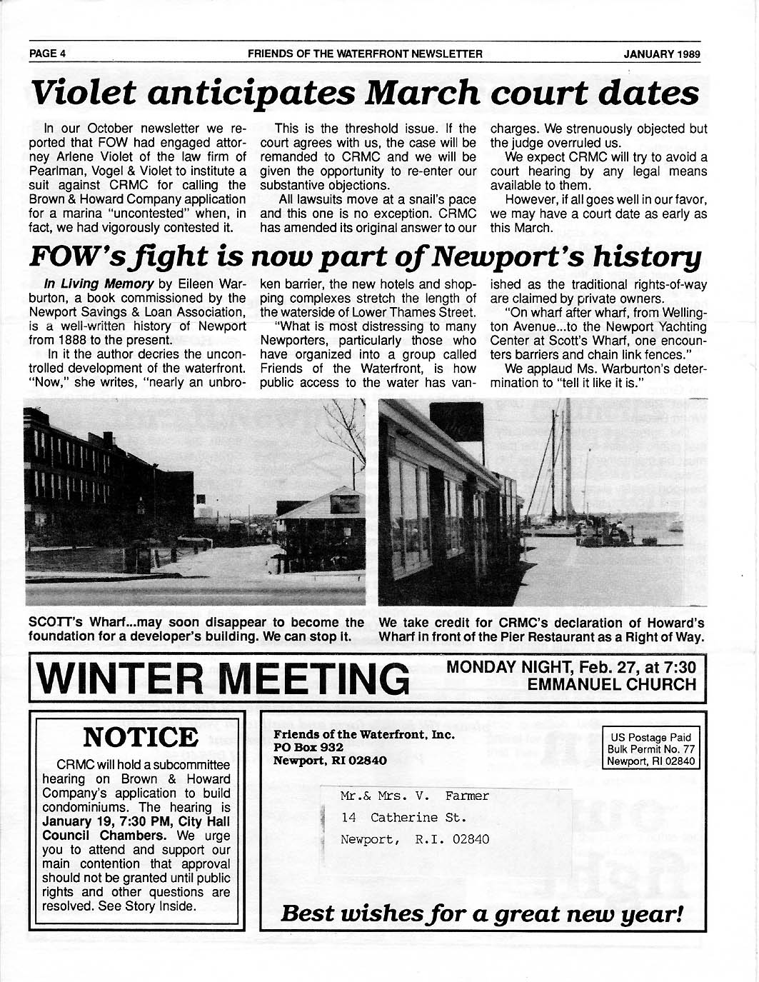
Jan. 1989 NEWSLETTER - - City Council
Flunks on 1988 Waterfront Planning and Protection. FoW calls for everyone to
help save public access on waterfront; hires Arlene Violet to sue CRMC for not
hearing FoW testimony in Brown and Howard condo filing.
P
1 | P 2 |
P 3 |
P 4 |
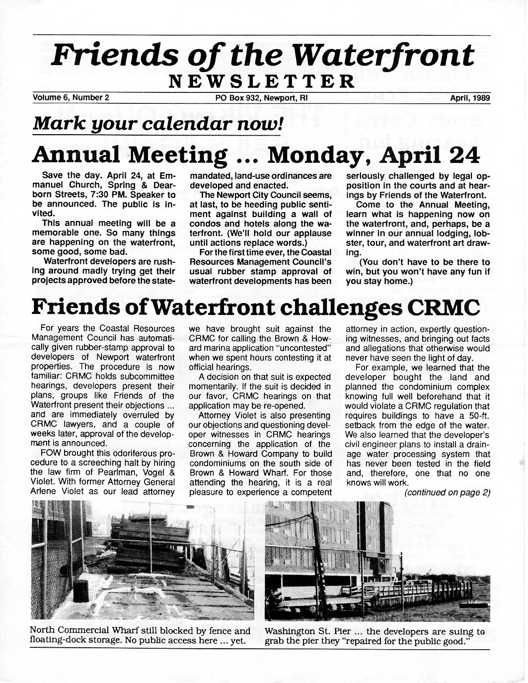
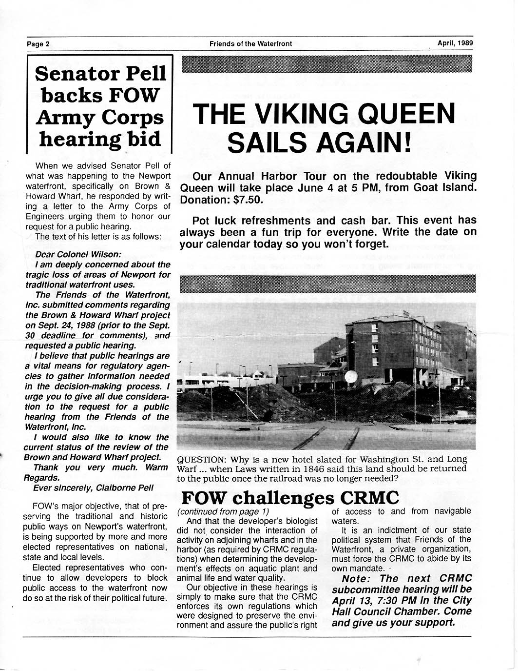
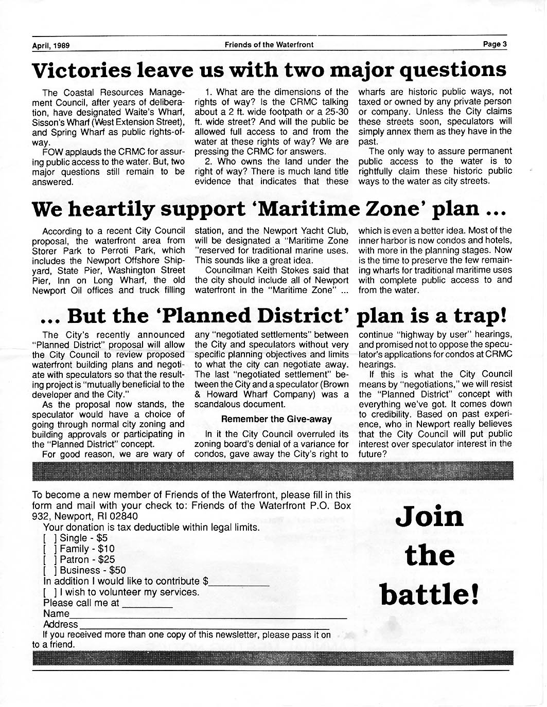
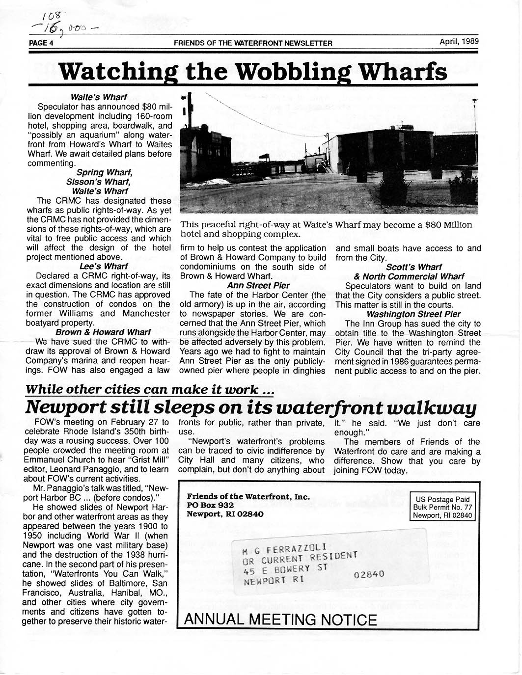
April 1989
NEWSLETTER - - Violet continues actions against CRMC.
Sen. Pell asked Army Corps of Engineers to check out the Brown and Howard Plan.
FoW gets CRMC to designate 3 more Rights of Way. FoW supports the 'Maritime
Zone' plan.
P
1 | P 2 |
P 3 |
P 4 |
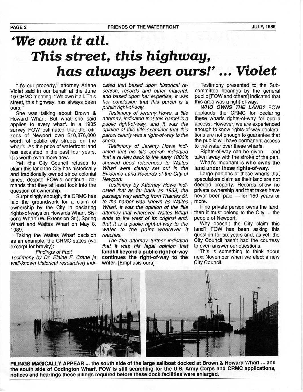
July 1989
NEWSLETTER - - FoW's Attorney Violet Upsets CRMC's Rubber
Stamp Subcommittee in Brown and Howard Condo Development Proposal. FoW leads
fight to prevent Planned Unit Developments under which the City Council could
allow developers to bypass zoning, planning and other normal hearings.
P
1 | P 2 |
P 3 |
P 4 |
Feb. 1990
NEWSLETTER - - 30Ft. Rights of Way Were Established in
1739 and Protected by City Council's for 250 Years, But Will it End? And Will
CRMC Follow Its Own Regulation that All Buildings Must Have a 50ft. Setback
from Coastal Waters? P 1 |
P 2 |
P 3 |
P 4
|
April 1990 NEWSLETTER - - What FoW
Stands For and Why! P 1 |
P 2 |
P 3 |
P 4 |
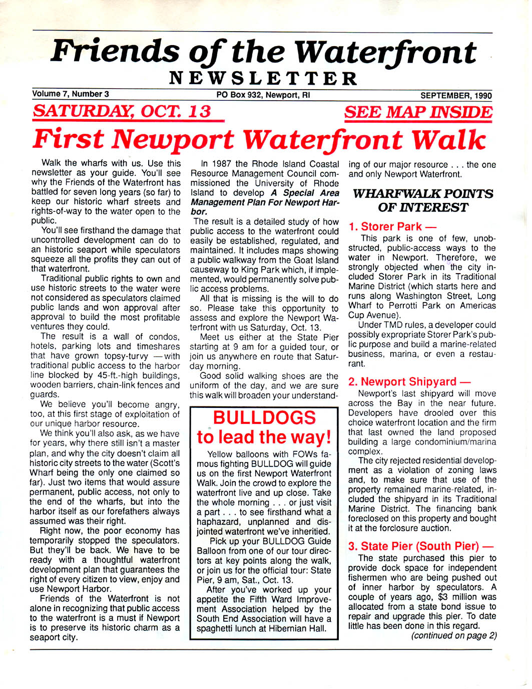
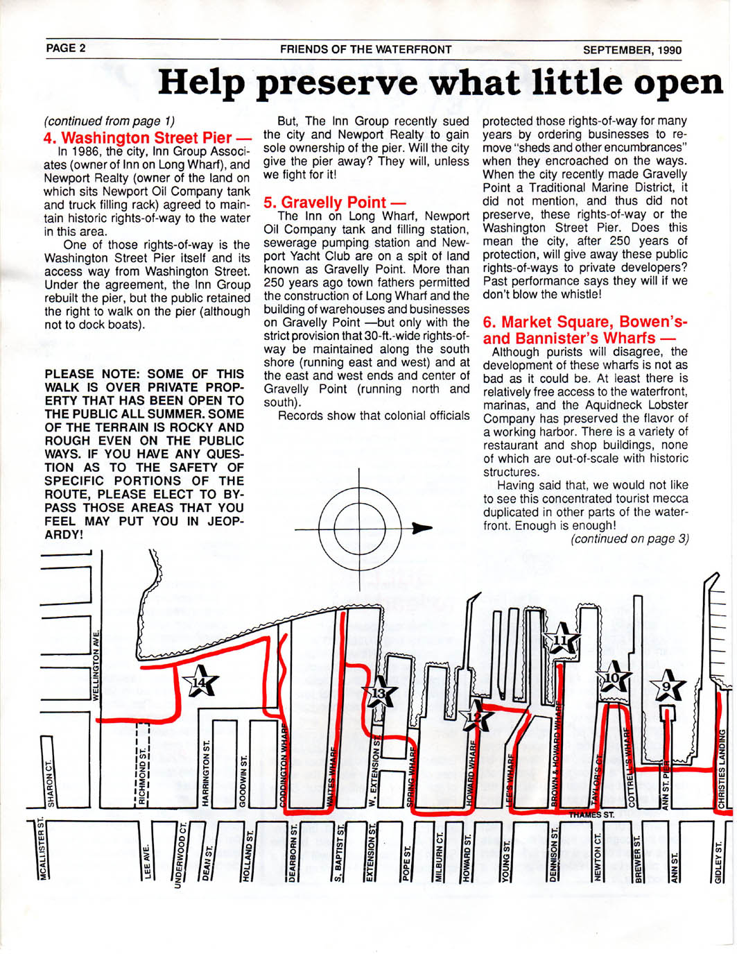
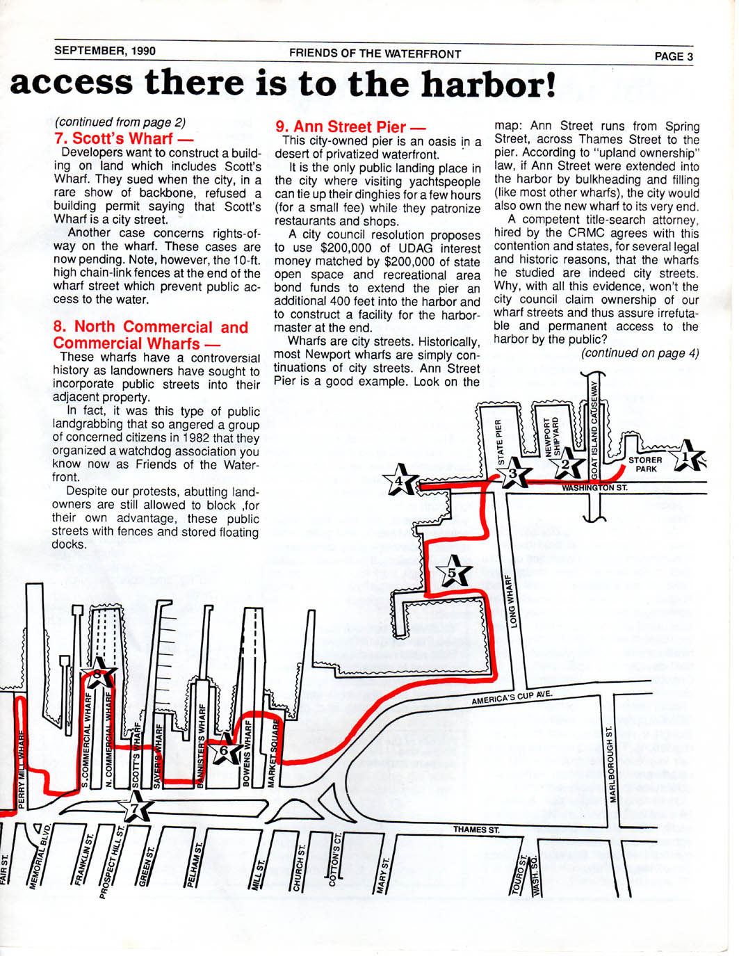
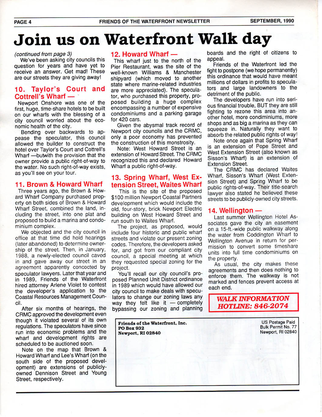
Sept. 1990
NEWSLETTER - - First FoW Waterfront Walk Including a Map
of Highlights.
P 1 |
P 2 |
P 3 |
P 4 |

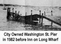
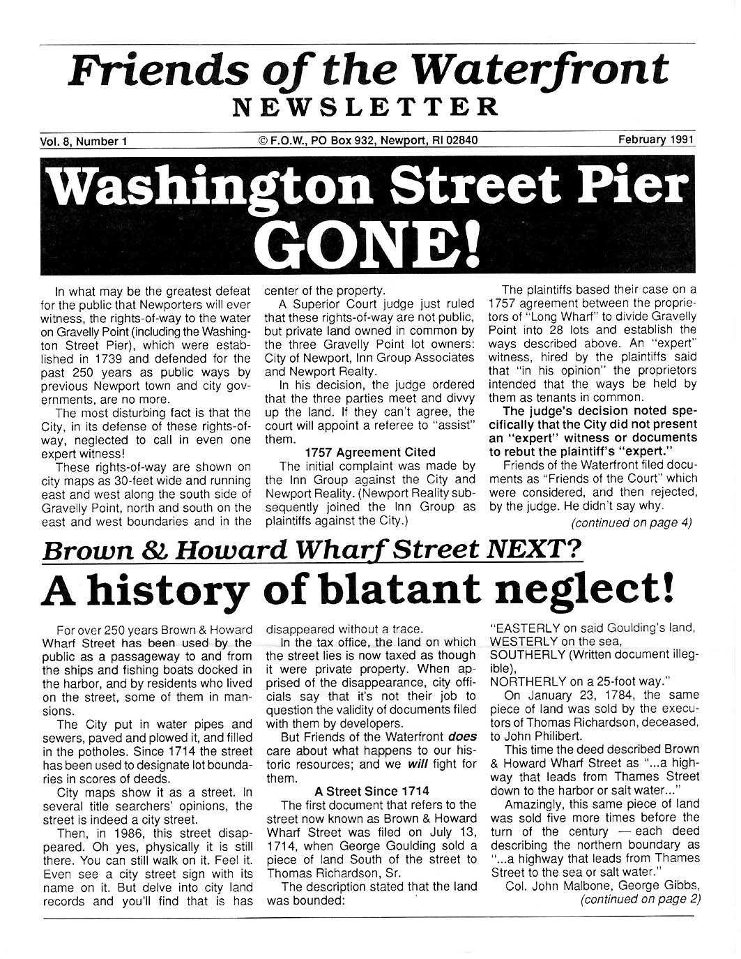
Feb. 1991 NEWSLETTER - -
City' Fails to Protect Public Ownership of Washington St. Pier. FoW's Case
Against Brown and Howard Explained.
P 1 |
P 2 |
P 3 |
P 4 |
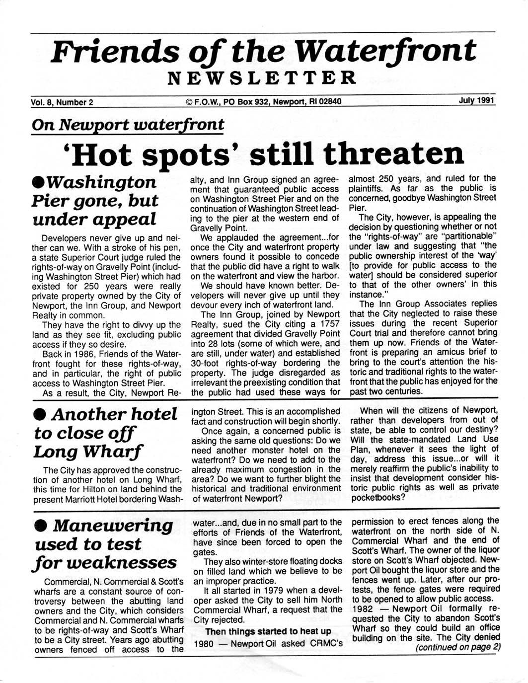
July 1991
NEWSLETTER - - Seven "Hot Spots" Where Waterfront
Developers Work Hard Against Established Public Access.
P 1 |
P 2 |
P 3 |
P 4
|
Sept. 1991 NEWSLETTER - - Our Second
Annual Waterfront Walk Promotion Newsletter
P 1 |
P 2 |
P 3 |
P 4
|
Oct. 1991 NEWSLETTER - - RI Supreme
Court Affirms Submerged Tidal and Navigable Waters Owned by State and Held in
Trust for the Public. FoW Membership Hits 1200.
P 1 |
P 2 |
P 3 |
P 4 |
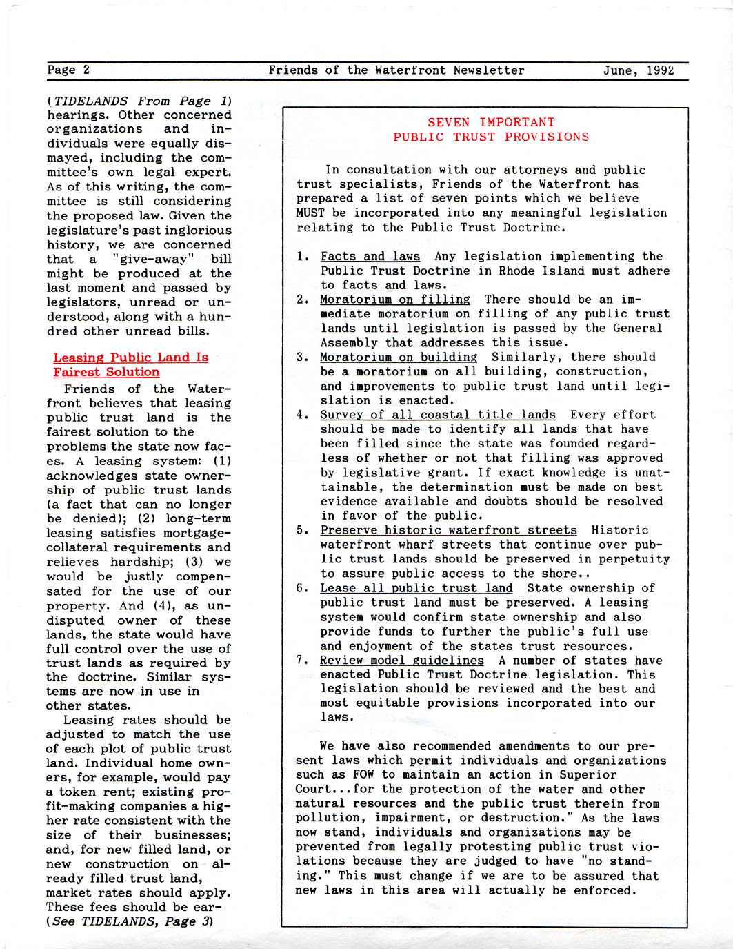
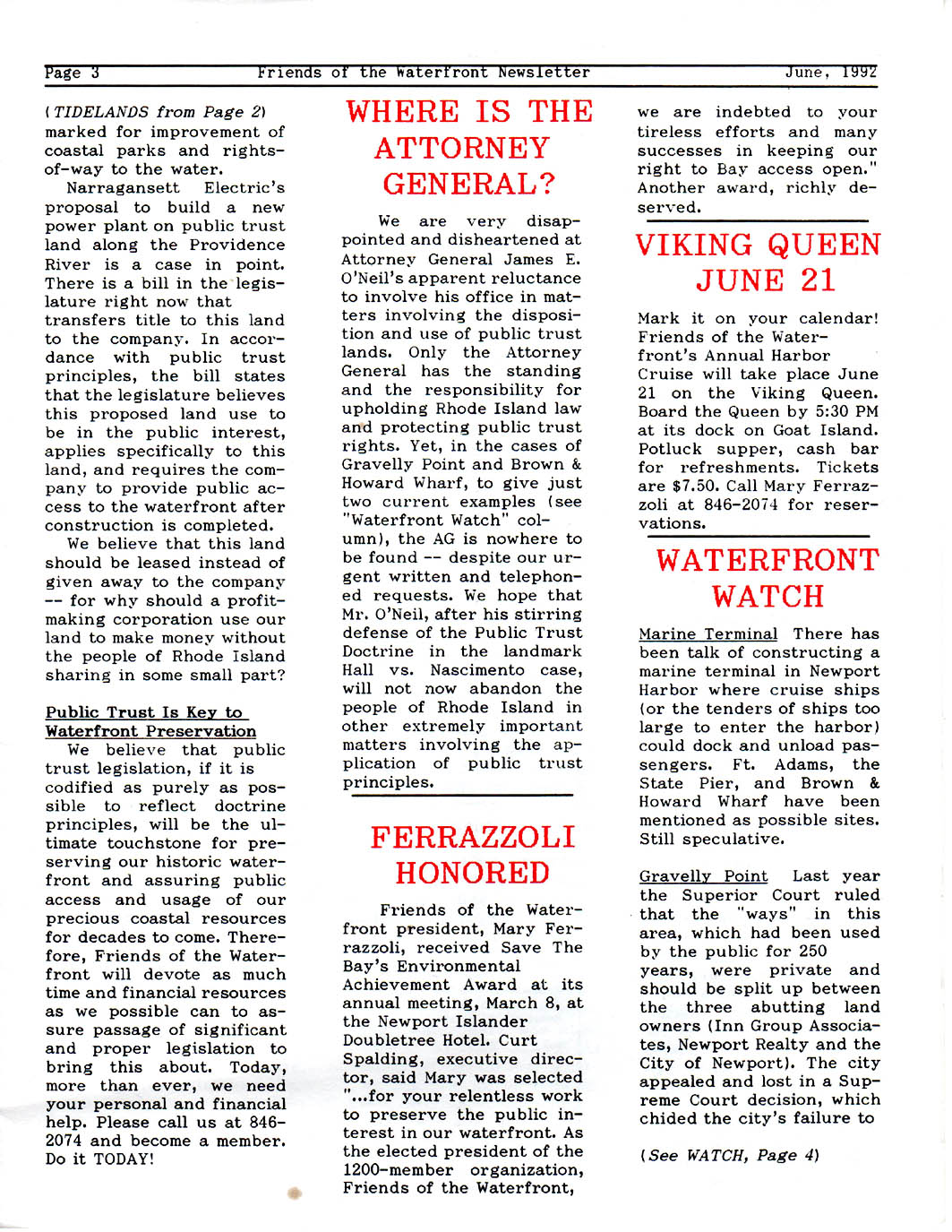
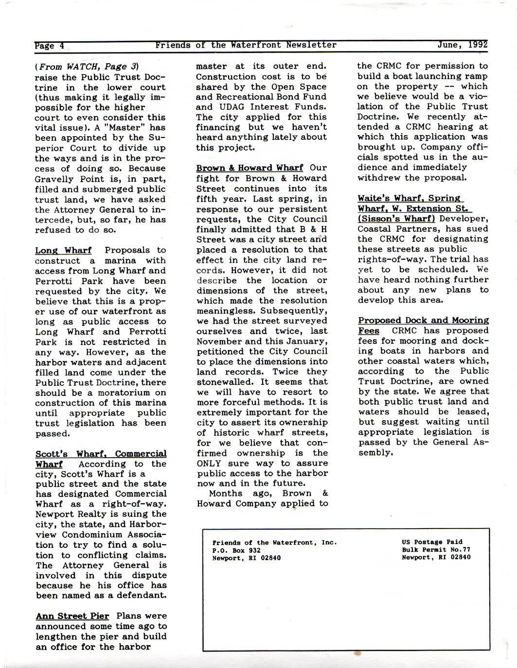
June
1992 NEWSLETTER - - Complete Explanation of RI's Public
Trust Doctrine. Pres. Ferrazzoli Receives Save the Bay Environmental
Achievement Award.
P 1 |
P 2 |
P 3 |
P 4
|
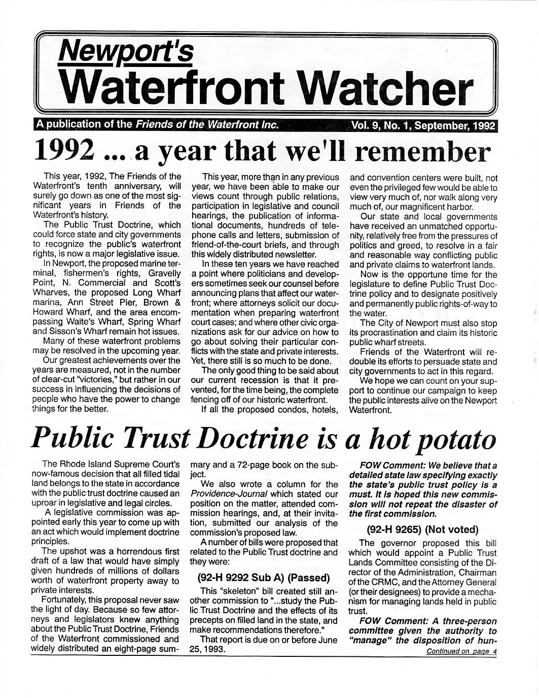
Sept. 1992 NEWSLETTER - - RI Supreme
Court Decides All Filled Tidall Land is "Public Property." RI Legislature Tries
to Modify Ruling Fails. FoW Starts Campaign to Ensure Fishermen Get Decent
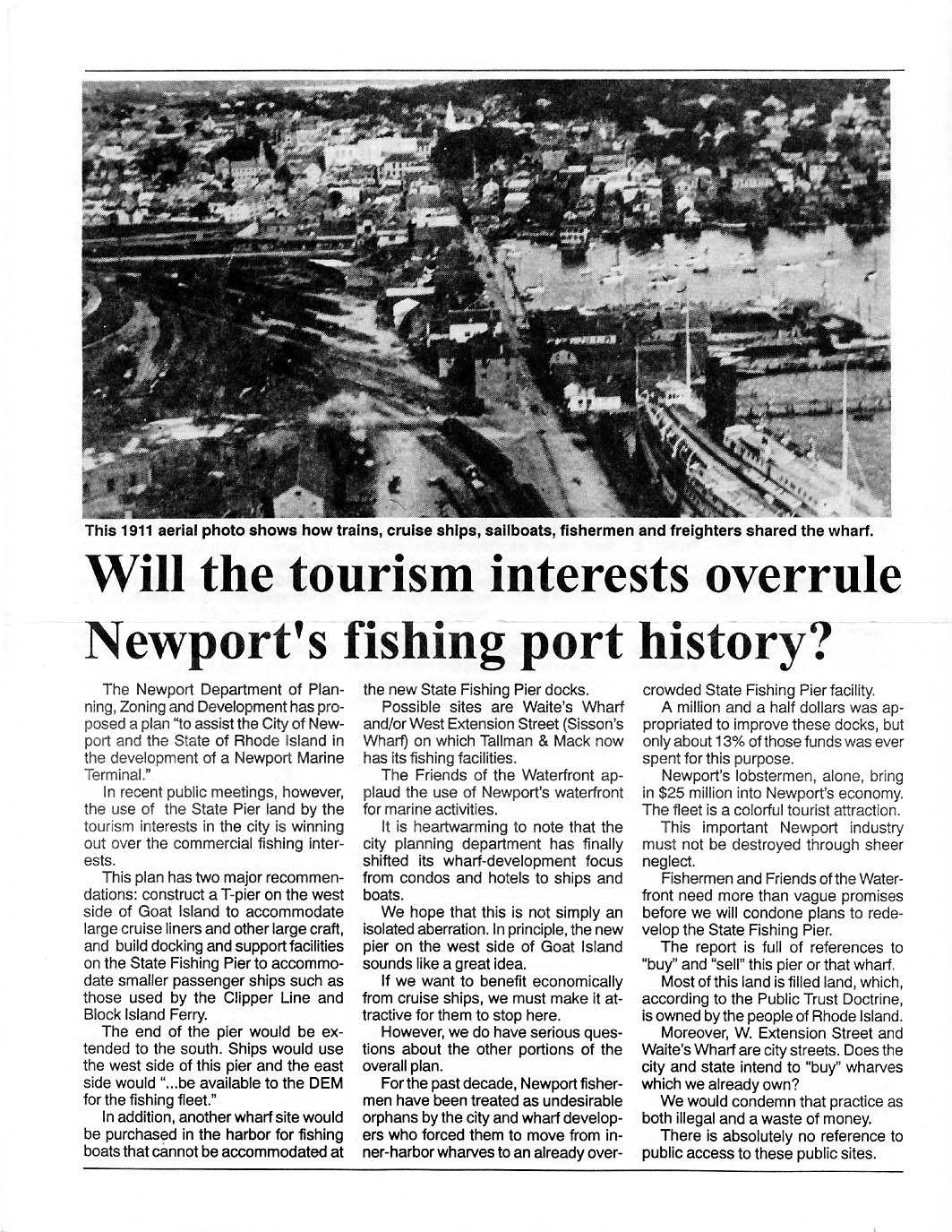
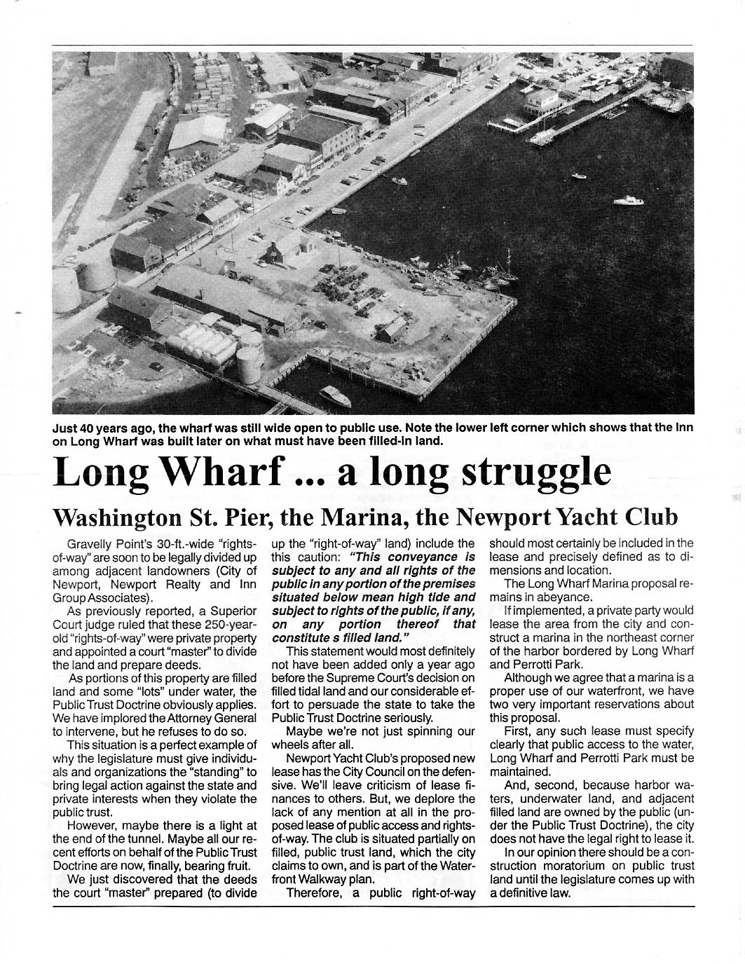
Place for Their Boats. Photos of Long Wharf 1911 and 1952.
P
1 | P 2 |
P 3 |
P 4 |
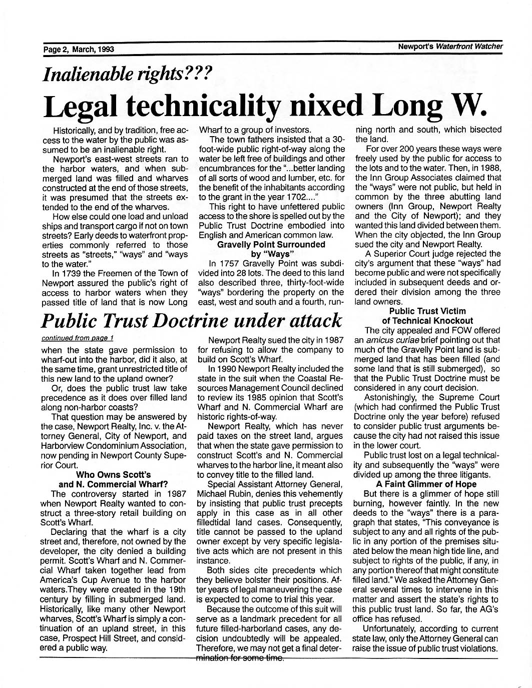
Mar. 1993
NEWSLETTER - - FoW Starts Campaign to Enforce RI's Public
Trust Doctrine that Mandates that Shoreline Below the Mean-High-Tide Line is
Public Property. FoW Starts Campaign for Referendum Petition to Get Rights of
Way Protection on Ballot.
P 1 |
P 2 |
P 3 |
P 4 |
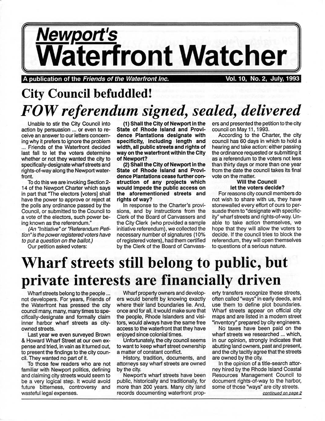
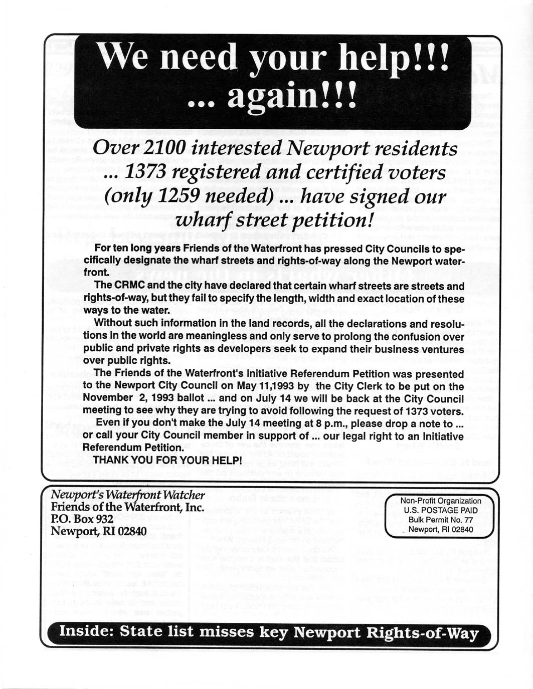
July
1993 NEWSLETTER - - FoW Announces that its Campaign for
Referendum Petition to Get Rights of Way Protection on Ballot has 2100
Signatures and Qualifies for the Ballot!
P 1 |
P 2 |
P 3 |
P 4 |
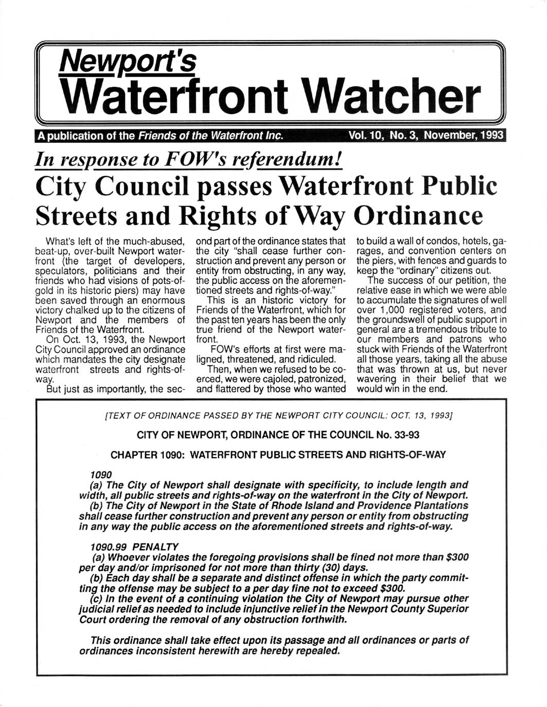
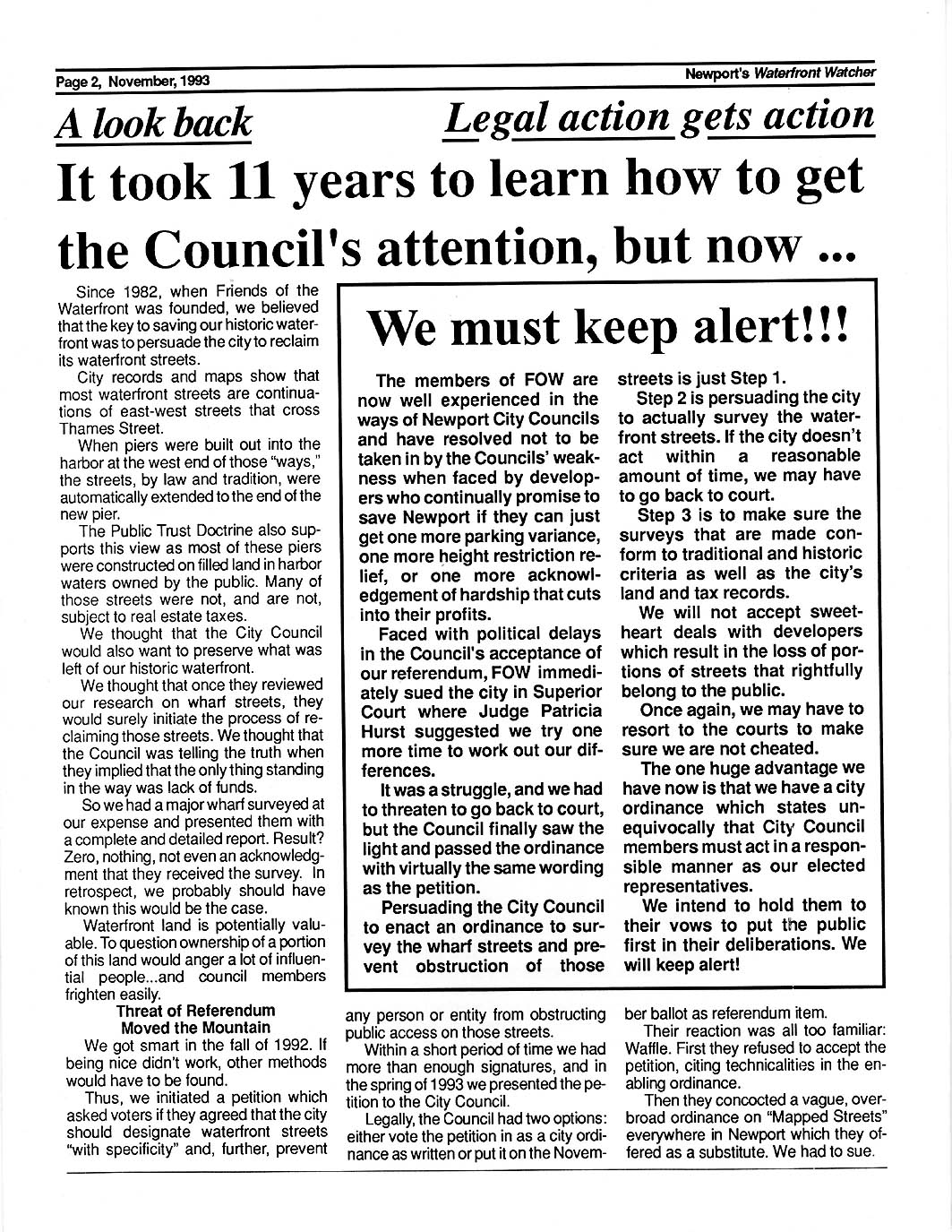
Nov.
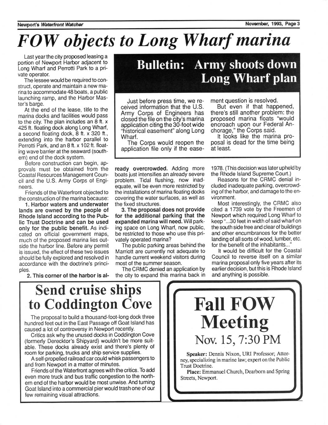
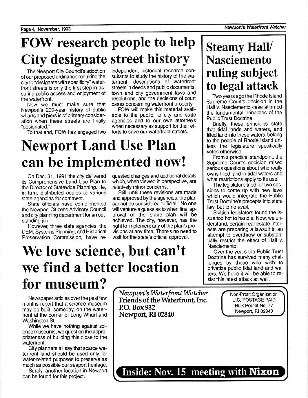
1993 NEWSLETTER - - In Response to FoW's Referendum, City
Council Passes Waterfront Public Streets and Rights of Way Ordinance! FoW
Objects to 'Long Wharf Marina."
P 1 |
P 2 |
P 3 |
P 4 |
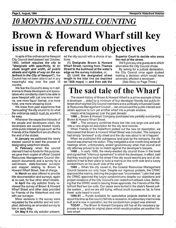
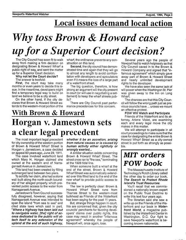
Aug.
1994 NEWSLETTER - - Our Mary ... 1928--1994;
City Council Stalls Brown and Howard Case, Kicks it up to Superior
Court
P 1 |
P 2 |
P 3 |
P 4 |
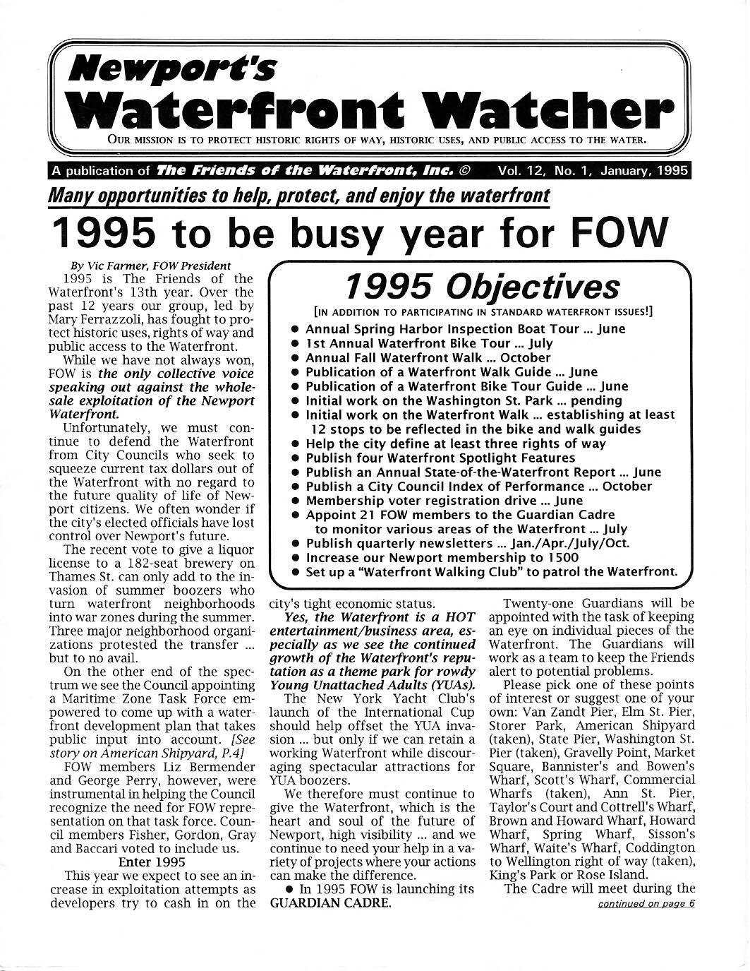
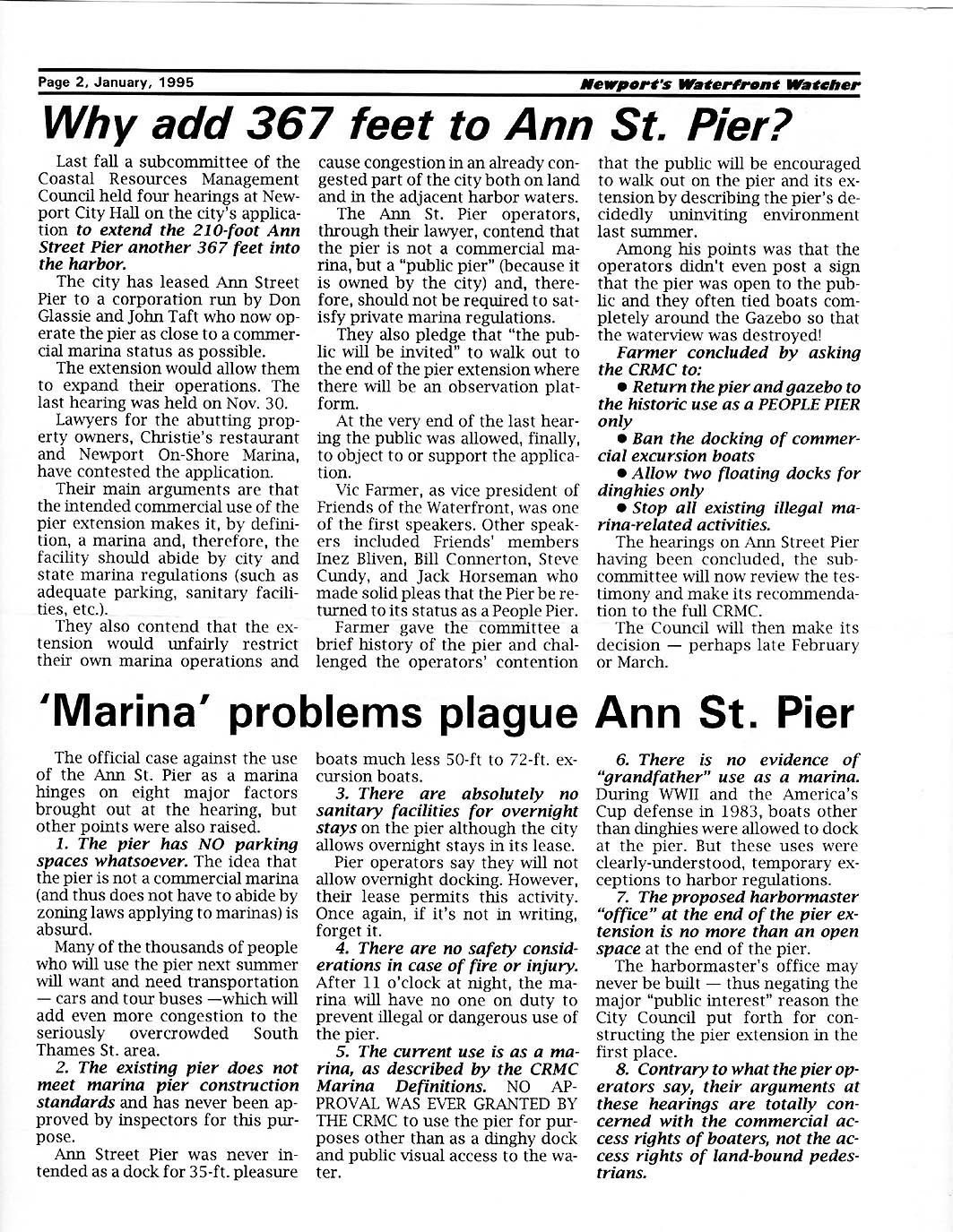
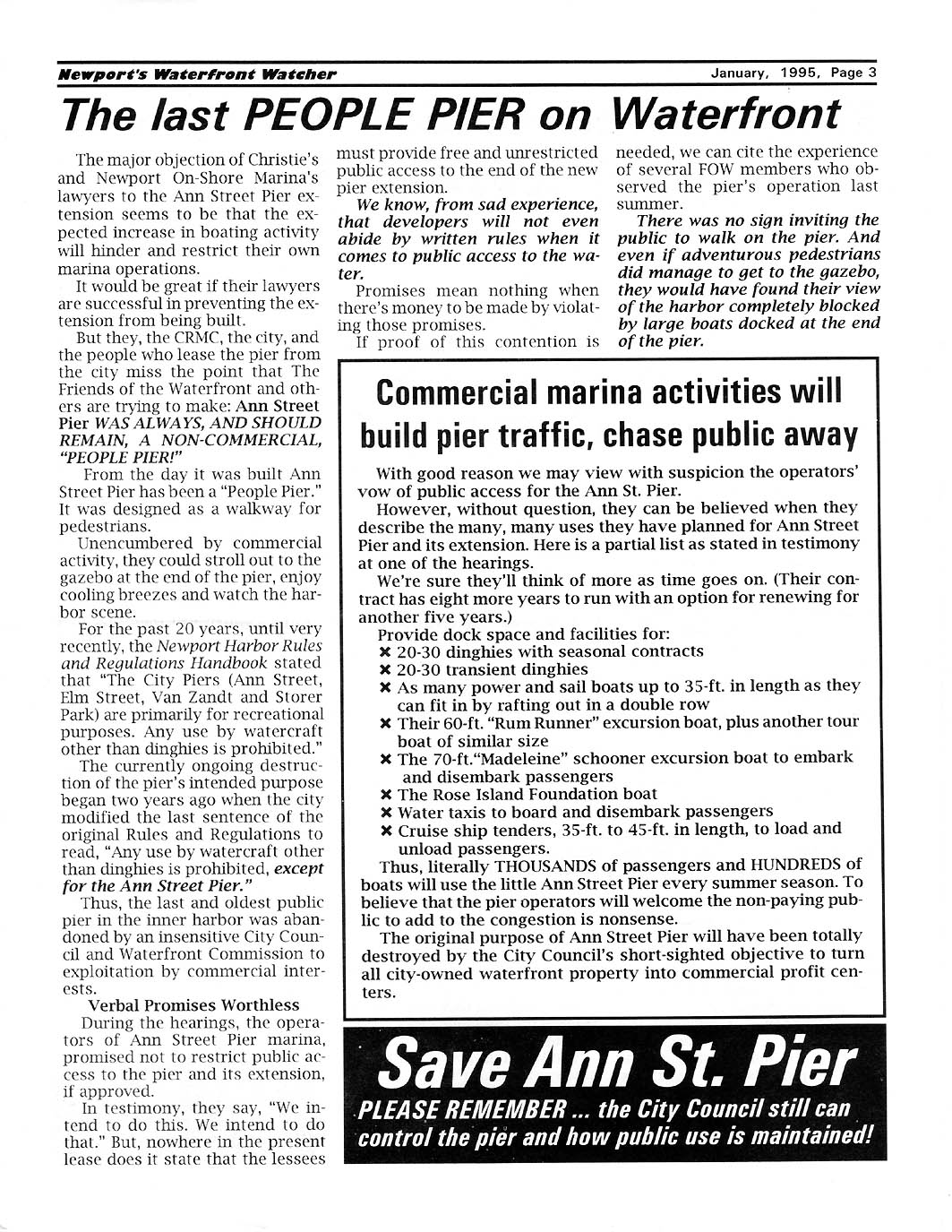
Jan. 1995
NEWSLETTER - - Strong Program of Activities and
Objectives Set for Year, Battle to Keep Ann St. Pier for Landside Walking Use
Launched.
P 1 |
P 2 |
P 3 |
P 4 |
P 5 |
P 6 |
April 1995 NEWSLETTER - - FoW's First
Ten Year Plan for Harbor Walk; and Launcing the First Harbor Walk Coalition
Meeting
P 1 |
P 2 |
P 3 |
P 4 |
P 5 |
P 6 |
P 7 |
P 8
|
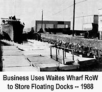
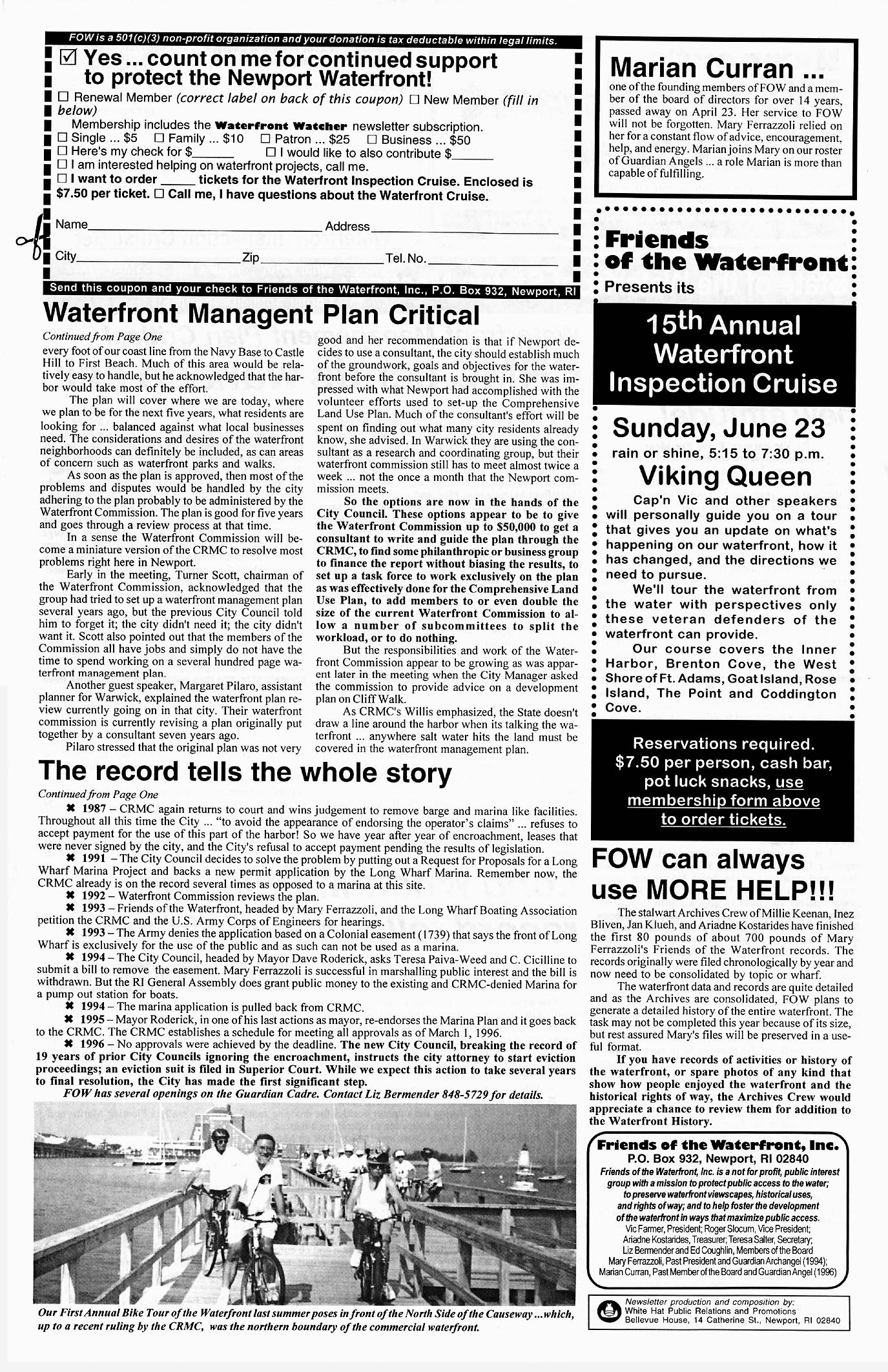
July 1995 NEWSLETTER - - Newport Bicycle Task Force and
FoW Set Up First Waterfront Bike Tour. Quaterly Update: FoW Offers to Pay for
Ann St. Pier Safety Review., Elizabeth Meyers Buys Site for IYRS. Problems
Surface at Waites Wharf.
P 1 |
P 2 |P 3 |P 4 |
May
1996 NEWSLETTER - - CRMC Upset at Newport''s Inaction ...Tells City to Get a
Waterfront Mangagement Plan!!!
FoW Continues Bike
Tours. P 1 |
P 2 |

To print a copy of the
Original Bike Tour use these links to the jpg files.
Map | Text |
Feb. 1997
NEWSLETTER - - City Tries to Launch Waterfront Management Plan, Foundation
for Newport Sets $20M Waterfront Plan.
P 1 |
P 2 |
May 1998
NEWSLETTER - - Newport City Council Just Walks Away from Cliff
Walk!
P 1 |
P 2 |
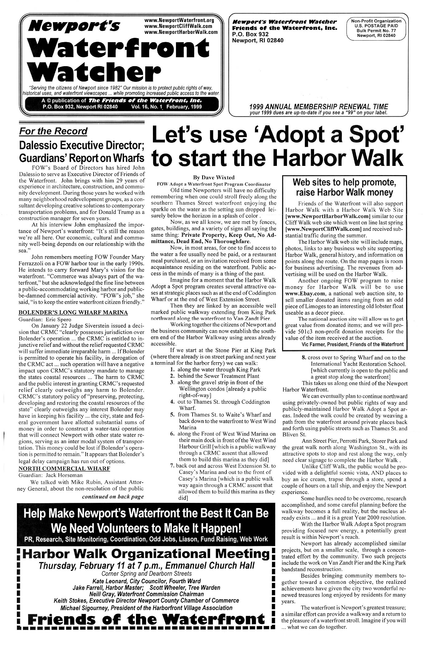
Feb. 1999
NEWSLETTER - - First Major city wide Harbor Walk Orgainzational Meeting
scheduled. FoW Promotes Waterfront 'Adopt a Spot' Featuring Point Association
work at Van Zandt Pier. FoW Guardians report on 6 shoreline problem
areas.
P 1 |
P 2 |
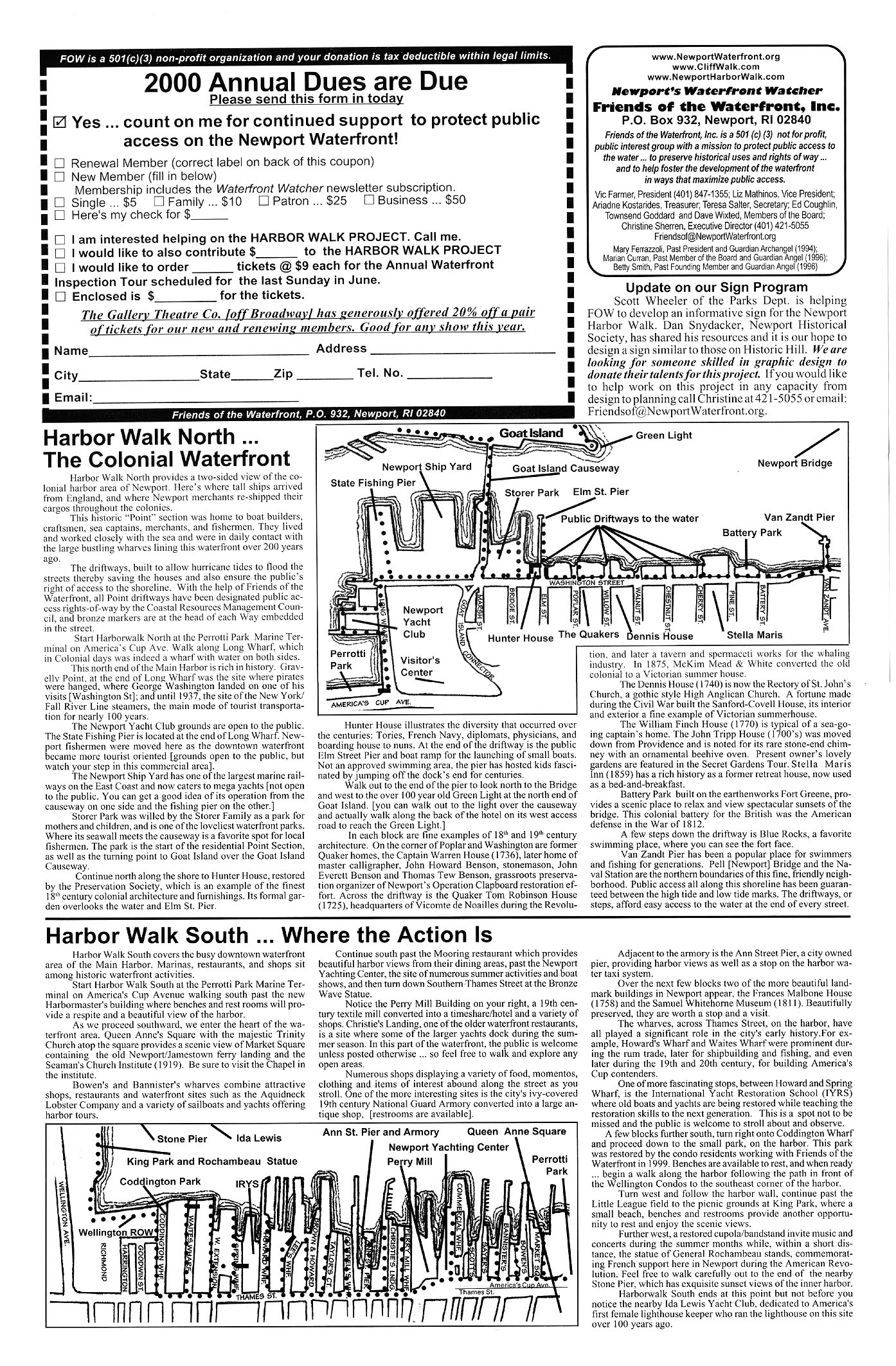
May 2000
NEWSLETTER - - FoW Prints 10,000 of the first ever Newport Harbor Walk Map
featuring Harbor Walk North -- The Colonial Waterfront; and Harbor Walk South
-- Where the Action Is
P 1 |
P 2 |
Spring
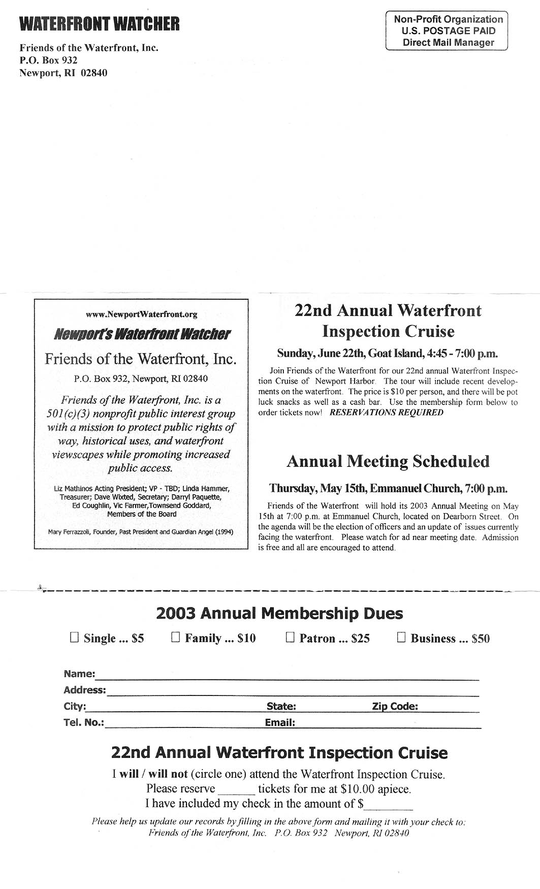
2003 NEWSLETTER - - President Darryl Paquette Summarizes FoW at the
Crossroads. Updates on King Park and Other Hot
Spots
P 1 |
P 2
|
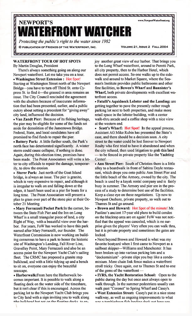
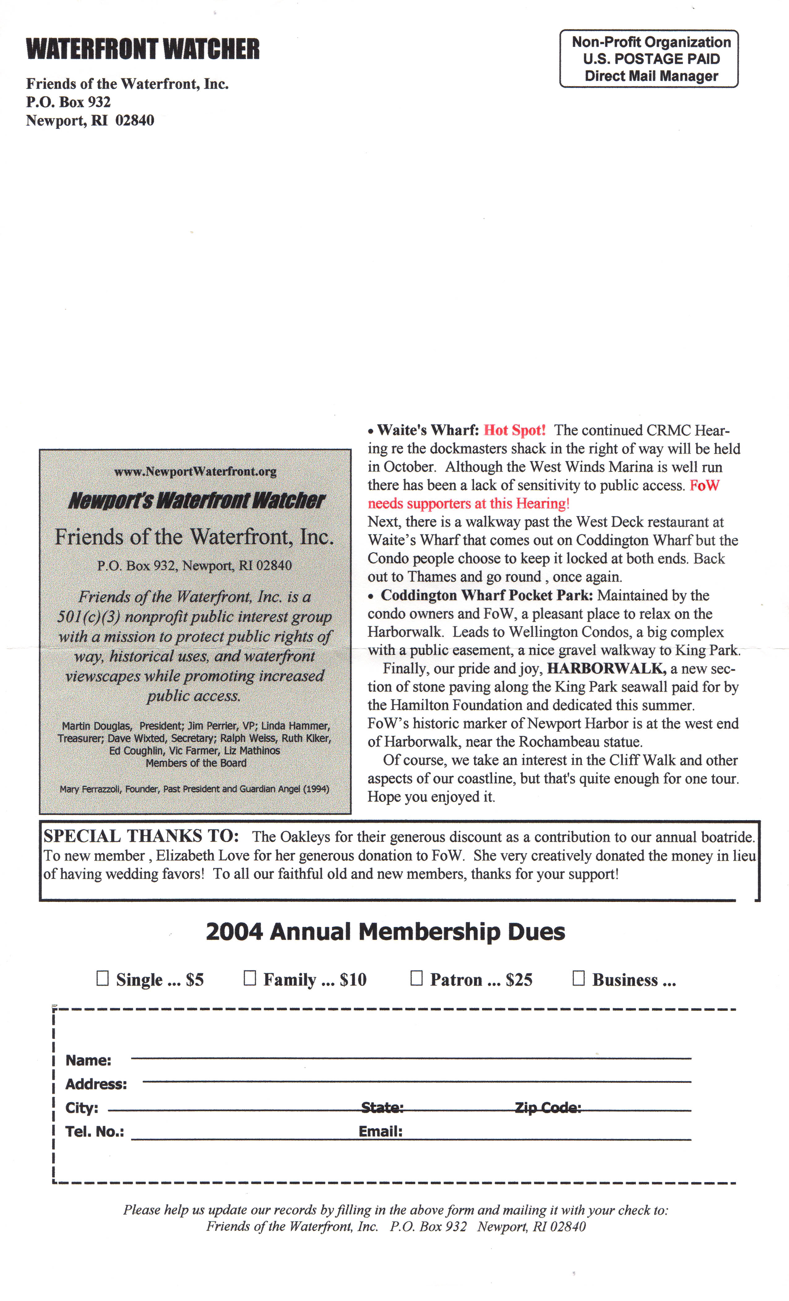
Fall 2004 NEWSLETTER - - Good Review of 14 Hot Spots on
Waterfront.
P 1 |
P 2
|
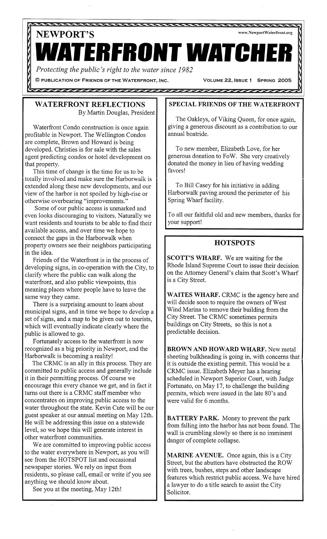
Spring 2005 NEWSLETTER - - A Look Forward with notes
on Battery Park, Scott's Wharf RI Supreme Court Action, and Marine Av.
P 1 | P 2 |
Fall 2005
NEWSLETTER - - Follow up Edition from Spring 2005 with Photo Coverage.
P 1 |
P 2 |
Spring
2006 NEWSLETTER - - FoW has Premiere Showing of Video Documentary "History
of our Waterfront;" CRMC and FoW Joint Effort to Mark 23 Rights of
Way
P 1 | P
2 | P 3 |
P 4 |
Summer 2007
NEWSLETTER - - 25th Year Recap
P 1 | P
2 | P 3 |
P 4 |
Summer 2008 NEWSLETTER- - Joint Program with
City to Mark Harbor Walk with Signage
P 1 |
P 2 |
P 3 |
P 4 |
Spring 2009 NEWSLETTER [pdf] - -
Dedication of Mary Ferrazzoli Park. FoW Moves Forward with Sign
Program.
Park Dedication Program with M. Ferrazzoli
Biography: P 1 |
P 2 |
Spring 2010 NEWSLETTER [pdf] - - Launch
of the Harbor Walk Tour Program

Spring
2011 NEWSLETTER - - Court Agrees with FoW Position on Washington St.
Extension
P 1 |
P 2 |
P 3 |
P 4 |
Spring 2012 NEWSLETTER
[pdf] - - Highlights from our
First 30 Years
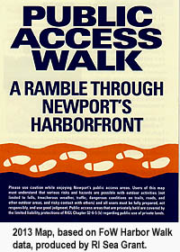
Spring 2013
NEWSLETTER [pdf]- - New Newport Shoreline Tour Map Features Harbor
Walk
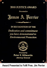
Fall 2014 NEWSLETTER - - Jim Perrier passes on,
Concerns raised on rising waterlevels over next 20 years. P1 |
P2 | P3 | P4
 Over 32 Years History
to Protect Public
Access
to the Newport Coastline! |
|
|
|
|
|